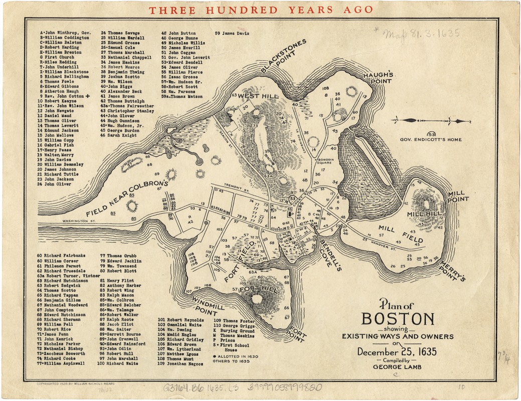
Plan of Boston showing existing ways and owners on December 25, 1635
Item Information
- Title:
- Plan of Boston showing existing ways and owners on December 25, 1635
- Creator:
- Lamb, George.
- Name on Item:
-
compiled by George Lamb.
- Date:
-
[ca. 1928]
- Format:
-
Maps/Atlases
- Location:
-
Boston Public Library
Norman B. Leventhal Map Center - Collection (local):
-
Norman B. Leventhal Map Center Collection
- Subjects:
-
Homeowners--Massachusetts--Boston--Maps
Landowners--Massachusetts--Boston--Maps
Boston (Mass.)--History--Colonial period, ca. 1600-1775--Maps
- Places:
-
Suffolk (county)Boston
- Extent:
- 1 plan ; 20 x 25 cm.
- Terms of Use:
-
No known copyright restrictions.
No known restrictions on use.
- Publisher:
-
S.l :
[William Nichols Mears]
- Scale:
-
Scale not given.
- Language:
-
English
- Notes:
-
Oriented with north to the right.
Relief shown by hachures.
Includes index to names of landowners.
- Identifier:
-
06_01_003256
- Call #:
-
G3764.B6 1635 .L3
- Barcode:
-
39999058999820


