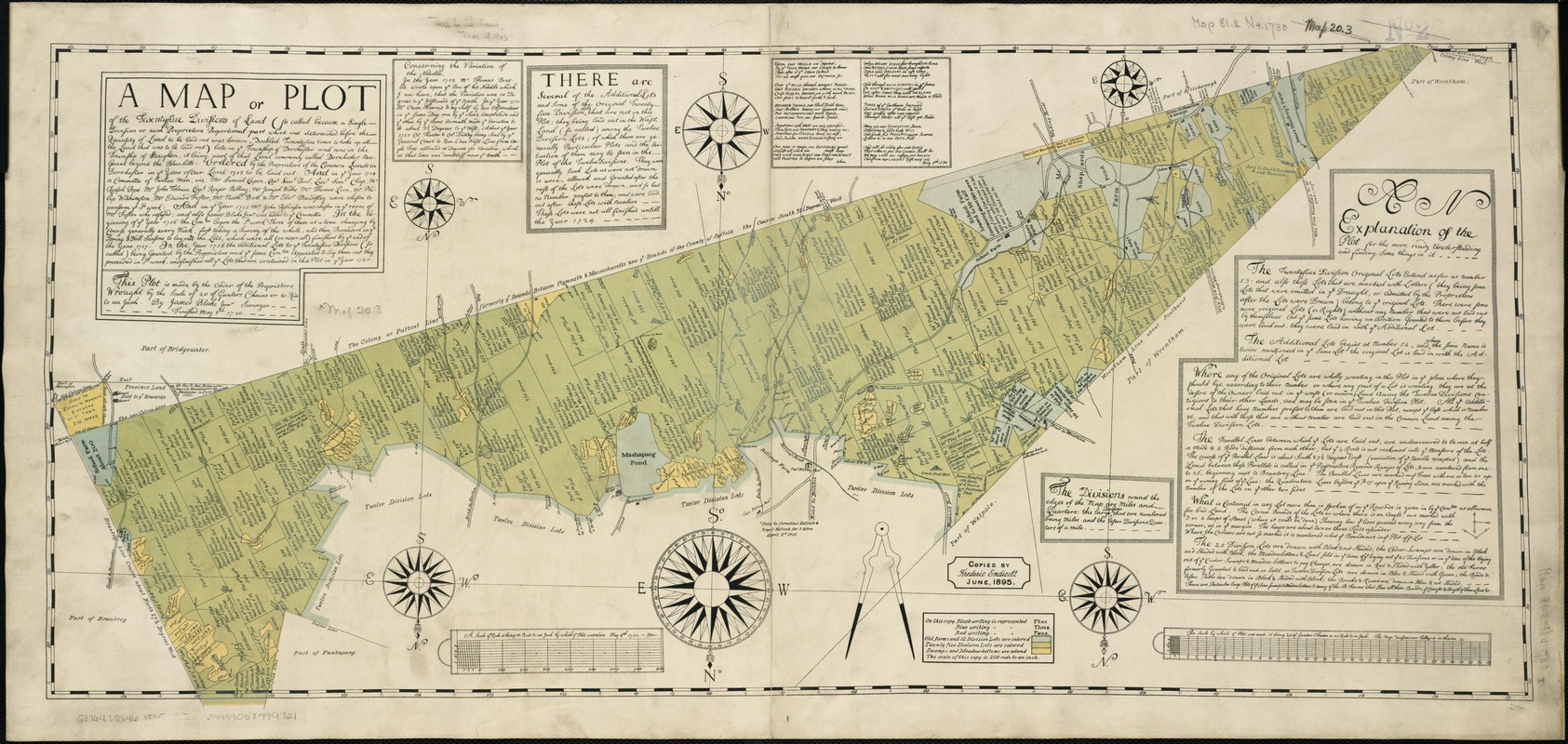
A map or plot of the twenty-five divisions of land ... late in the Township of Dorchester and now in the Township of Stoughton, it being part of that land commonly called Dorchester New-Grant beyond the Blew-hills ... finished May 8th, 1730
Item Information
- Title:
- A map or plot of the twenty-five divisions of land ... late in the Township of Dorchester and now in the Township of Stoughton, it being part of that land commonly called Dorchester New-Grant beyond the Blew-hills ... finished May 8th, 1730
- Creator:
- Blake, James, 1688-1750
- Name on Item:
-
by James Blake ; copied by Frederic Endicott, June 1895.
- Date:
-
[1895]
- Format:
-
Maps/Atlases
- Location:
-
Boston Public Library
Norman B. Leventhal Map Center - Collection (local):
-
Norman B. Leventhal Map Center Collection
- Subjects:
-
Real property--Massachusetts--Stoughton--Maps
Real property--Massachusetts--Dorchester (Boston, Mass.)--Maps
Stoughton (Mass.)--Maps
- Places:
-
Suffolk (county)BostonDorchester
Norfolk (county)Stoughton
- Extent:
- 1 map ; 36 x 81 cm.
- Terms of Use:
-
No known copyright restrictions.
No known restrictions on use.
- Publisher:
-
Boston, Mass :
s.n.
- Scale:
-
Scale ca. 1:15,840.
- Language:
-
English
- Notes:
-
Oriented with north to the bottom.
Includes blocks of text.
- Notes (date):
-
This date is inferred.
- Identifier:
-
06_01_003246
- Call #:
-
G3764.S8G46 1895 .B5
- Barcode:
-
39999058999721


