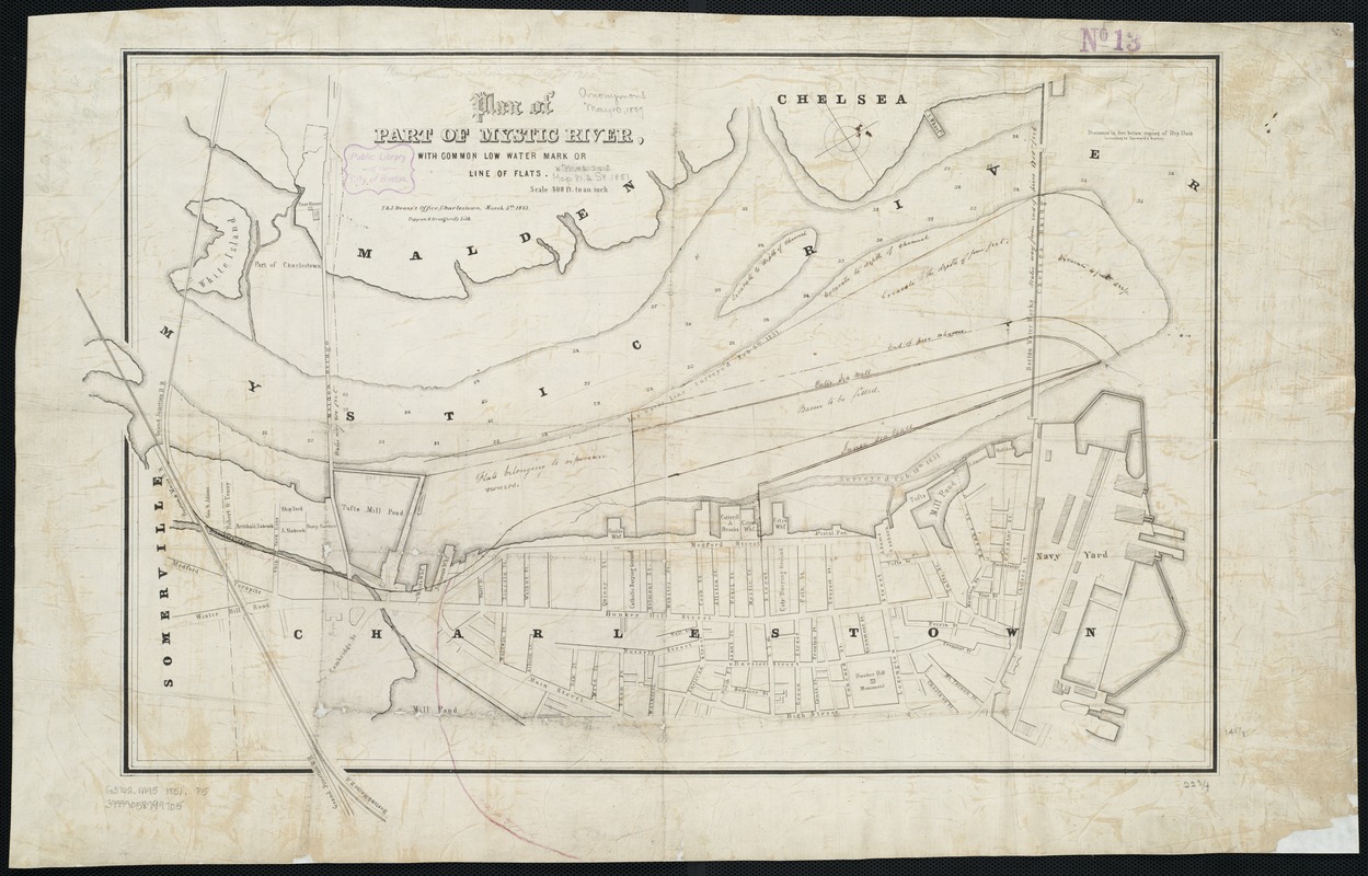
Plan of part of Mystic River, with common low water mark of line of flats
Item Information
- Title:
- Plan of part of Mystic River, with common low water mark of line of flats
- Date:
-
[1851]
- Format:
-
Maps/Atlases
- Location:
-
Boston Public Library
Norman B. Leventhal Map Center - Collection (local):
-
Norman B. Leventhal Map Center Collection
- Subjects:
-
Mystic River (Mass.)--Maps
- Places:
-
Mystic (river)
- Extent:
- 1 plan ; 41 x 61 cm.
- Terms of Use:
-
No known copyright restrictions.
No known restrictions on use.
- Publisher:
-
Charlestown, Mass :
T. & J. Doane
- Scale:
-
Scale [ca. 1:4,800].
- Language:
-
English
- Notes:
-
Depths shown by soundings.
Oriented with north toward the upper left.
T. & J. Doane's Office, Charlestown, March 5th, 1851."
- Notes (date):
-
This date is inferred.
- Identifier:
-
06_01_003244
- Call #:
-
G3762.M95 1851 .P5
- Barcode:
-
39999058999705


