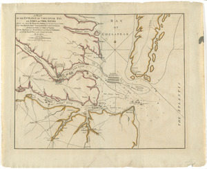
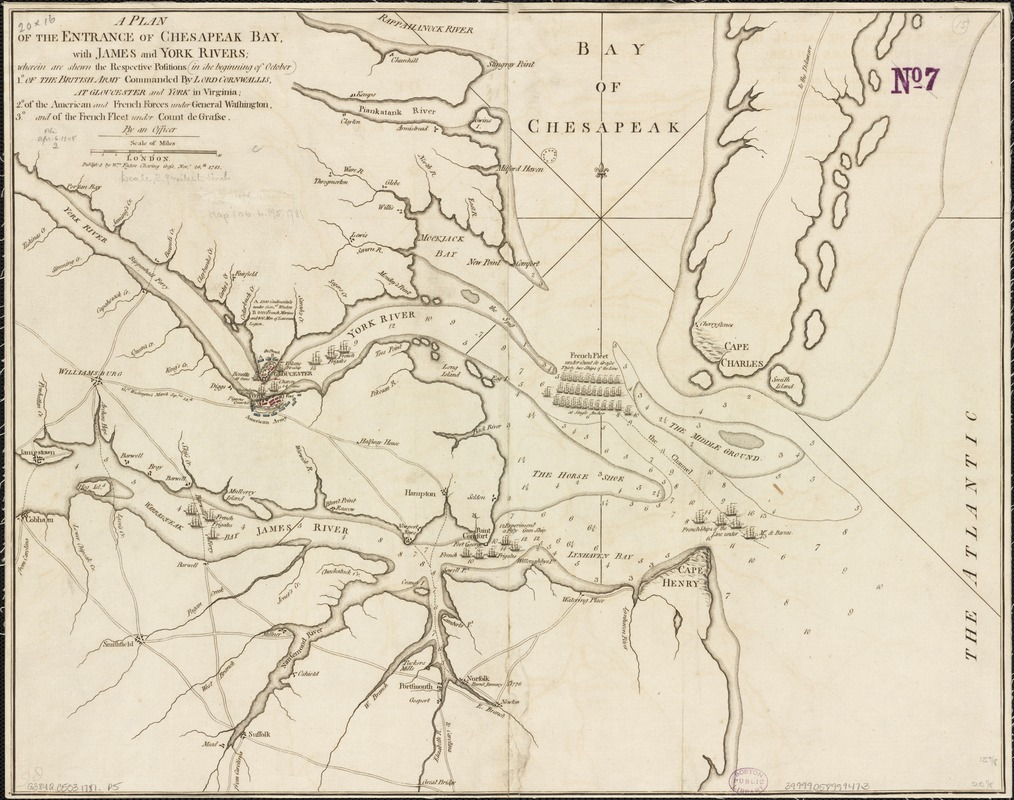
A plan of the entrance of Chesapeak Bay, with James and York rivers : wherein are shewn the respective positions (in the beginning of October) 1⁰. of the british army commanded by Lord Cornwallis, at Gloucester and York in Virginia; 2⁰. of the American and French forces under General Washington; 3.⁰ and of the French Fleet under Count de Grasse
This map is also available in American Revolutionary Geographies Online (ARGO), a collections portal especially built for material relating to the American Revolutionary War Era. Visit ARGO to learn more about this item and explore the historical geography of North America in the late eighteenth century.
Item Information
- Title:
- A plan of the entrance of Chesapeak Bay, with James and York rivers : wherein are shewn the respective positions (in the beginning of October) 1⁰. of the british army commanded by Lord Cornwallis, at Gloucester and York in Virginia; 2⁰. of the American and French forces under General Washington; 3.⁰ and of the French Fleet under Count de Grasse
- Name on Item:
-
by an officer.
- Date:
-
1781
- Format:
-
Maps/Atlases
- Location:
-
Boston Public Library
Norman B. Leventhal Map Center - Collection (local):
-
Norman B. Leventhal Map Center Collection
- Subjects:
-
Yorktown (Va.)--History--Siege, 1781--Maps--Early works to 1800
United States--History--Revolution, 1775-1783--Participation, French--Maps--Early works to 1800
York River (Va.)--History--18th century--Maps--Early works to 1800
James River (Va.)--History--18th century--Maps--Early works to 1800
- Places:
-
York (river)
James (river)
- Extent:
- 1 map ; 41 x 51 cm.
- Terms of Use:
-
No known copyright restrictions.
No known restrictions on use.
- Publisher:
-
London :
Wm. Faden
- Scale:
-
Scale [ca. 1:250,000]
- Language:
-
English
- Notes:
-
Relief shown pictorially.
Depth shown by soundings.
Appears in the publisher's Atlas of battles of the American Revolution. [1845].
- Identifier:
-
06_01_003219
- Call #:
-
G3842.C5S3 1781 .P5
- Barcode:
-
39999058999473
- LCCN:
-
74692131