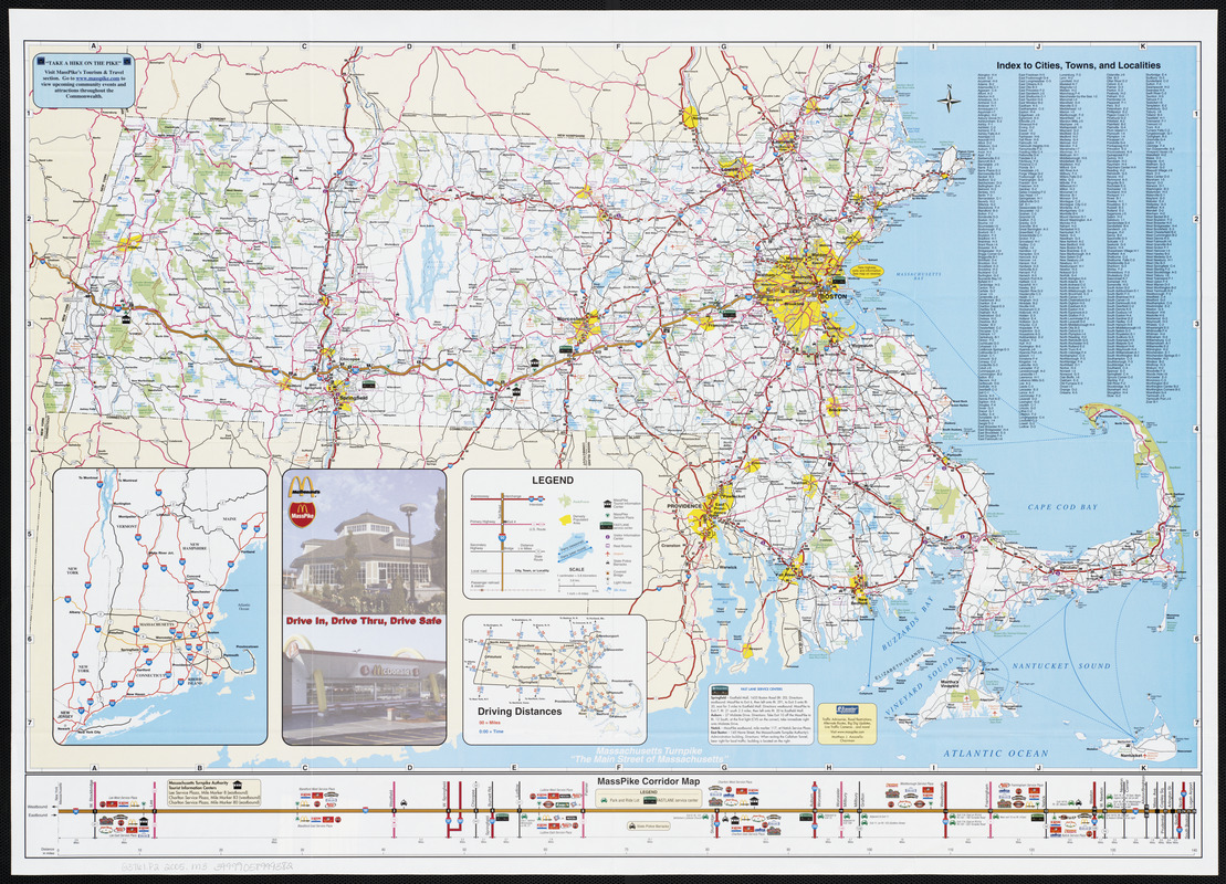
Massachusetts Turnpike map : the main street of Massachusetts

Item Information
- Title:
- Massachusetts Turnpike map : the main street of Massachusetts
- Cartographer:
- Massachusetts Turnpike Authority
- Name on Item:
-
issued by Massachusetts Turnpike Authority
- Date:
-
2005
- Format:
-
Maps/Atlases
- Location:
-
Boston Public Library
Norman B. Leventhal Map Center - Collection (local):
-
Norman B. Leventhal Map Center Collection
- Subjects:
-
Massachusetts--Maps
Roads--Massachusetts--Maps
Boston (Mass.)--Maps
Worcester (Mass.)--Maps
Springfield (Mass.)--Maps
- Places:
-
Suffolk (county)Boston
Worcester (county)Worcester
Hampden (county)Springfield
- Extent:
- 1 map : both sides, col. ; 47 x 76 cm., on sheet 57 x 79 cm
- Terms of Use:
-
No known copyright restrictions.
No known restrictions on use.
- Publisher:
-
Boston, Mass. :
MassPike
- Scale:
-
Scale approximately 1:380,000
- Language:
-
English
- Notes:
-
Includes index to cities, towns, and localities and driving distances map, MassPike corridor map and location map.
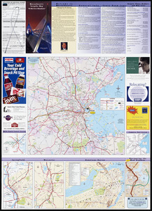
Text, advertisements, region map, commuter rail system map, MBTA rapid transit systems map, navigating the new highway map, and inset maps of Springfield, Worcester, and downtown Boston on verso.
- Identifier:
-
06_01_003209
06_01_003210
- Call #:
-
G3761.P2 2005 .M3
- Barcode:
-
39999058999382


