Plan des forts, batteries et poste de West-Point, 1780
Item Information
- Title:
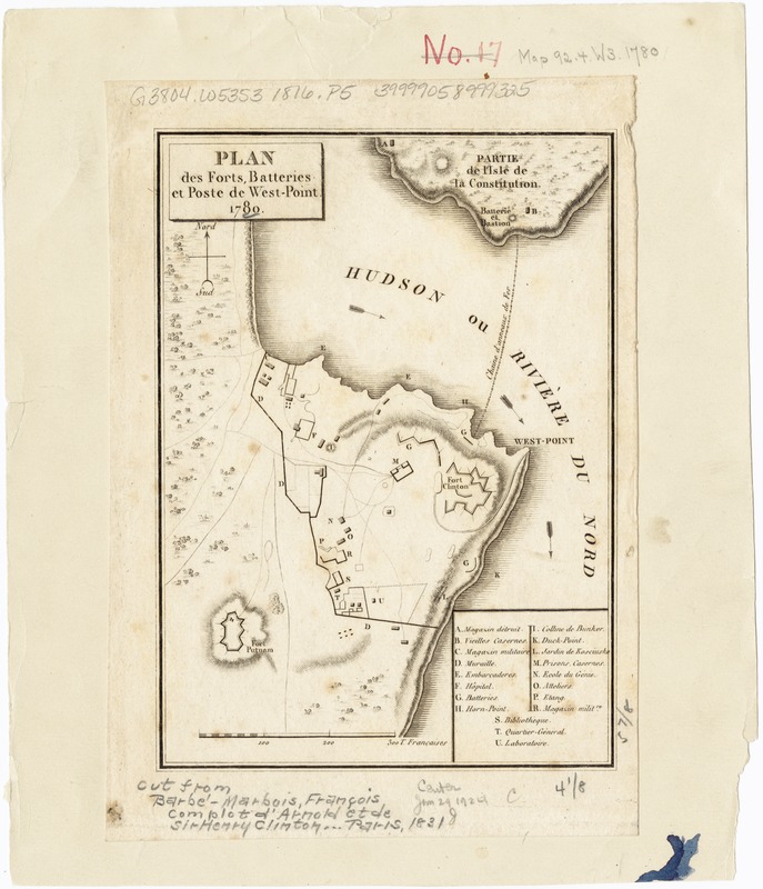
- Plan des forts, batteries et poste de West-Point, 1780
- Date:
-
[1831]
- Format:
-
Maps/Atlases
- Location:
-
Boston Public Library
Norman B. Leventhal Map Center - Collection (local):
-
Norman B. Leventhal Map Center Collection
- Subjects:
-
Fortification--New York (State)--West Point--Maps
West Point (N.Y.)--Buildings, structures, etc--Maps
New York (State)--History--Revolution, 1775-1783--Maps
1780
- Places:
-
Orange (county)West Point
- Extent:
- 1 map ; 16 x 11 cm.
- Terms of Use:
-
No known copyright restrictions.
No known restrictions on use.
- Publisher:
-
Paris :
P. Didot
- Scale:
-
Scale [ca. 1:13,000].
- Language:
-
French
- Notes:
-
Relief shown by hachures.
Shows fortifications.
Includes key to places of interest.
- Notes (date):
-
This date is inferred.
- Identifier:
-
06_01_003201
- Call #:
-
G3804.W53S3 1780 .P5
- Barcode:
-
39999058999325


