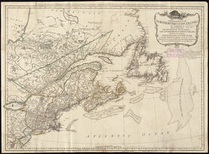
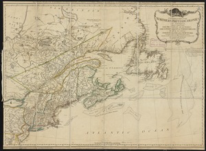
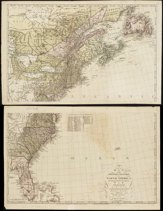
A new map of the British colonies in North America, shewing the seat of the present war, taken from the best surveys, compared with and improved from manuscripts of several noblemen and gentlemen
This map is also available in American Revolutionary Geographies Online (ARGO), a collections portal especially built for material relating to the American Revolutionary War Era. Visit ARGO to learn more about this item and explore the historical geography of North America in the late eighteenth century.
Item Information
- Title:
- A new map of the British colonies in North America, shewing the seat of the present war, taken from the best surveys, compared with and improved from manuscripts of several noblemen and gentlemen
- Creator:
- Andrews, John, 1736-1809
- Name on Item:
-
by John Andrews.
- Date:
-
1777
- Format:
-
Maps/Atlases
- Location:
-
Boston Public Library
Norman B. Leventhal Map Center - Collection (local):
-
Norman B. Leventhal Map Center Collection
- Subjects:
-
North America--History--Revolution, 1775-1783--Maps--Early works to 1800
- Places:
-
North America (area)
- Extent:
- 1 map on 2 sheets : col. ; 98 x 79 cm.
- Terms of Use:
-
No known copyright restrictions.
No known restrictions on use.
- Publisher:
-
London :
John Andrews ; Andrew Dury
- Scale:
-
Scale ca. 1:3,340,000.
- Language:
-
English
- Notes:
-
Hand colored.
Prime meridian: London.
Relief shown pictorially.
Published by John Andrews and Andrew Dury.
Includes listing of "References to the names of the countries not inserted in this map."
Cataloging, conservation, and digitization made possible in part by The National Endowment for the Humanities: Exploring the human endeavor.
- Identifier:
-
06_01_003189
- Call #:
-
G3301.S1 1777 .A5
- Barcode:
-
39999058999192
- LCCN:
-
gm 71005499