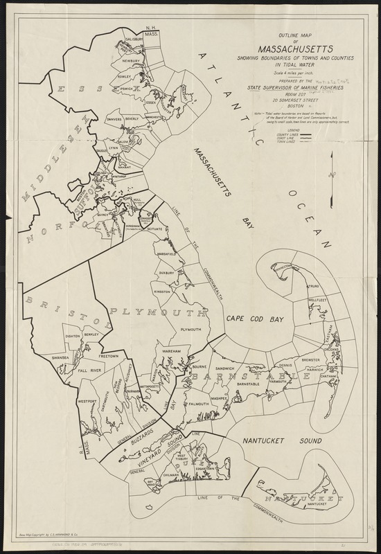
Outline map of Massachusetts showing boundaries of towns and counties in tidal water
Item Information
- Title:
- Outline map of Massachusetts showing boundaries of towns and counties in tidal water
- Creator:
- Massachusetts. Division of Marine Fisheries
- Name on Item:
-
prepared by the State Supervisor of Marine Fisheries.
- Date:
-
[1932?]
- Format:
-
Maps/Atlases
- Location:
-
Boston Public Library
Norman B. Leventhal Map Center - Collection (local):
-
Norman B. Leventhal Map Center Collection
- Subjects:
-
Tidal flats--Massachusetts--Maps
Coasts--Massachusetts--Maps
Massachusetts--Maps
- Places:
-
Massachusetts
- Extent:
- 1 map ; 78 x 52 cm.
- Terms of Use:
-
No known copyright restrictions.
No known restrictions on use.
- Publisher:
-
Boston, Mass :
[Mass. Division of Marine Fisheries]
- Scale:
-
Scale 1:253,440.
- Language:
-
English
- Identifier:
-
06_01_003113
- Call #:
-
G3762.C6 1932 .O9
- Barcode:
-
39999058998616


