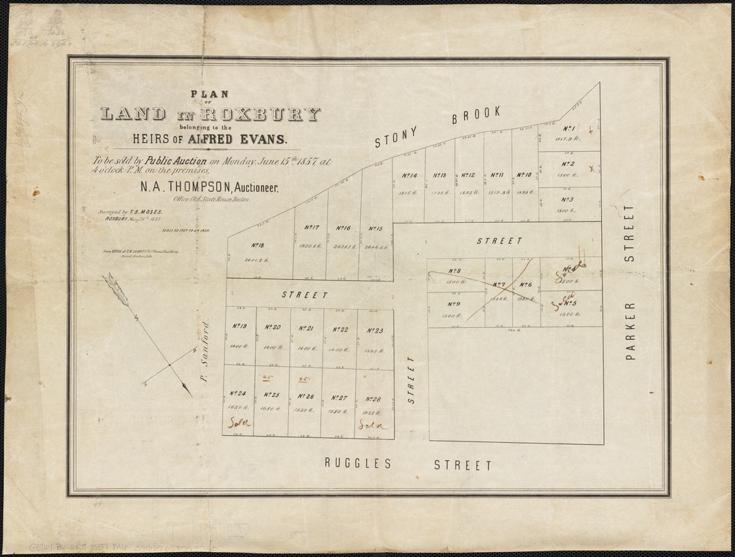
Plan of land in Roxbury belonging to the heirs of Alfred Evans
Item Information
- Title:
- Plan of land in Roxbury belonging to the heirs of Alfred Evans
- Creator:
- Moses, T. B.
- Name on Item:
-
surveyed by T.B. Moses.
- Date:
-
[1857]
- Format:
-
Maps/Atlases
- Location:
-
Boston Public Library
Norman B. Leventhal Map Center - Collection (local):
-
Norman B. Leventhal Map Center Collection
- Subjects:
-
Real property--Massachusetts--Boston--Maps
Roxbury (Boston, Mass.)--Maps
Roxbury (Boston, Mass.)
- Places:
-
Suffolk (county)BostonRoxbury
- Extent:
- 1 plan ; 30 x 42 cm.
- Terms of Use:
-
No known copyright restrictions.
No known restrictions on use.
- Publisher:
-
Boston, Mass :
T.H. Leavitt
- Scale:
-
Scale 1:360. 30 feet to an inch.
- Language:
-
English
- Notes:
-
Oriented with north toward the bottom right.
"To be sold by Public Auction on Monday, June 15th 1857, at 4 o'clock P.M. on the premises, N.A. Thompson, Auctioneer."
"Surveyed by T.B. Moses, Roxbury May 26th 1857."
- Notes (date):
-
This date is inferred.
- Identifier:
-
06_01_003079
- Call #:
-
G3764.B6:2R7 1857 .M6
- Barcode:
-
39999058997725


