Map of the county of Essex, Vermont
Item Information
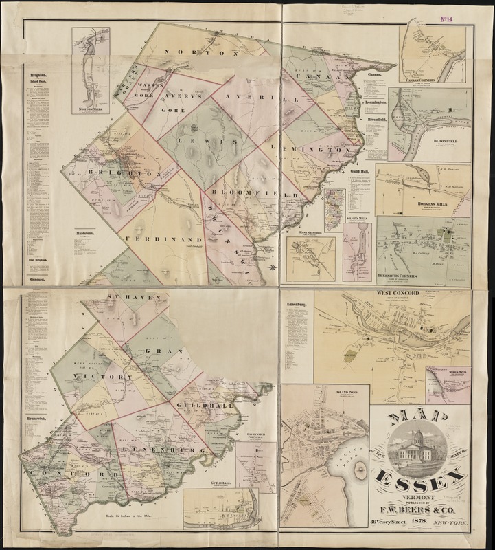
- Title:
- Map of the county of Essex, Vermont
- Creator:
- F.W. Beers & Co
- Date:
-
1878
- Format:
-
Maps/Atlases
- Location:
-
Boston Public Library
Norman B. Leventhal Map Center - Collection (local):
-
Norman B. Leventhal Map Center Collection
- Subjects:
-
Essex County (Vt.)--Maps
- Places:
-
Essex (county)
- Extent:
- 1 map : col. ; 142 x 122 cm.
- Terms of Use:
-
No known copyright restrictions.
No known restrictions on use.
- Publisher:
-
New York :
F.W. Beers & Co.
- Scale:
-
Scale [ca.1:50,688]. 1 1/4 in. to the mile.
- Language:
-
English
- Notes:
-
Relief shown by hachures.
Includes eleven insets.
Title ornamented with view of the state house, Montpelier, Vt.
- Identifier:
-
06_01_003051
- Call #:
-
G3753.E7 1878 .B4
- Barcode:
-
39999058997444


