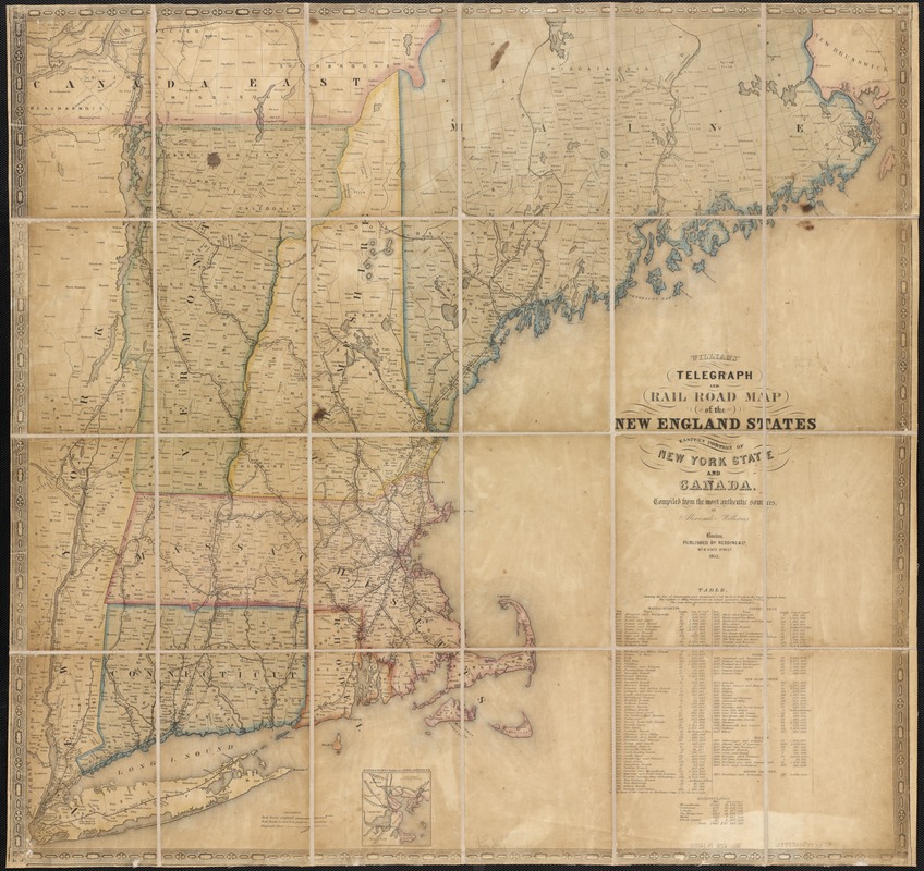
Williams' telegraph and rail road map of the New England states, eastern protion of New York state and Canada : compiled from the most authentic sources
Item Information
- Title:
- Williams' telegraph and rail road map of the New England states, eastern protion of New York state and Canada : compiled from the most authentic sources
- Creator:
- Williams, Alexander.
- Name on Item:
-
by Alexander Williams.
- Date:
-
1852
- Format:
-
Maps/Atlases
- Location:
-
Boston Public Library
Norman B. Leventhal Map Center - Collection (local):
-
Norman B. Leventhal Map Center Collection
- Subjects:
-
Railroads--New England--Maps
Railroads--New York (State)--Maps
Railroads--Canada--Maps
Telegraph lines--New England--Maps
Telegraph lines--New York (State)--Maps
Telegraph lines--Canada--Maps
New England--Maps
New York (State)--Maps
Canada--Maps
- Places:
-
New England (area)
New York
- Extent:
- 1 map : col. ; 75 x 79 cm.
- Terms of Use:
-
No known copyright restrictions.
No known restrictions on use.
- Publisher:
-
Boston, Mass :
Redding & Co.
- Scale:
-
Scale not given.
- Language:
-
English
- Notes:
-
Includes inset of Boston and vicinity, showing the Grand Junction R.R. and a table showing cost of construction of railroads throughout New England.
- Identifier:
-
06_01_003045
- Call #:
-
G3721.P1 1852 .W5
- Barcode:
-
39999058997378


