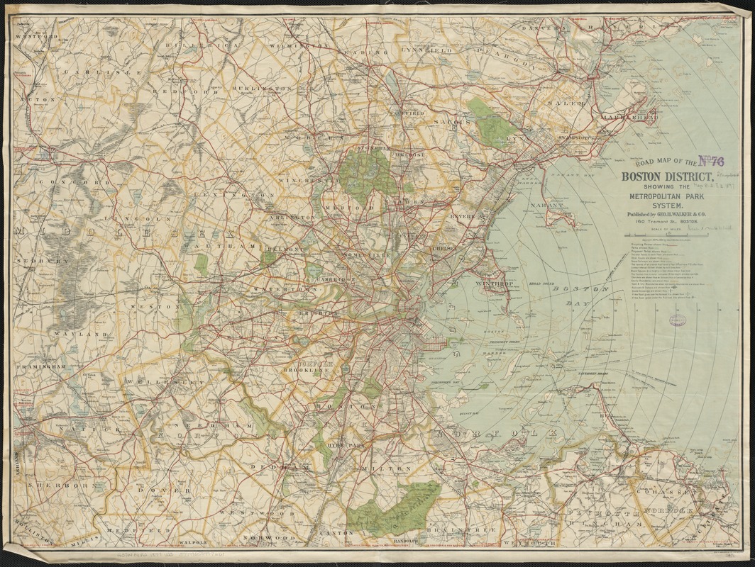
Road map of the Boston District, showing the metropolitan park system
Item Information
- Title:
- Road map of the Boston District, showing the metropolitan park system
- Creator:
- Geo. H. Walker & Co
- Date:
-
[ca. 1897]
- Format:
-
Maps/Atlases
- Location:
-
Boston Public Library
Norman B. Leventhal Map Center - Collection (local):
-
Norman B. Leventhal Map Center Collection
- Subjects:
-
Roads--Massachusetts--Maps
Recreation areas--Massachusetts--Boston--Maps
Boston (Mass.)--Maps
Massachusetts--Maps
- Places:
-
Suffolk (county)Boston
- Extent:
- 1 map : col. ; 67 x 89 cm.
- Terms of Use:
-
No known copyright restrictions.
No known restrictions on use.
- Publisher:
-
Boston, Mass :
Geo. H. Walker & Co.
- Scale:
-
Scale 1:63,360.
- Language:
-
English
- Notes:
-
Relief shown by contours and spot heights.
Shows bicycle routes.
Cocentric circles show miles from Boston.
- Identifier:
-
06_01_003034
- Call #:
-
G3764.B6P2 1897 .W3
- Barcode:
-
39999058997261


