Map of the country about Boston
Item Information
- Title:
- Map of the country about Boston
- Description:
-
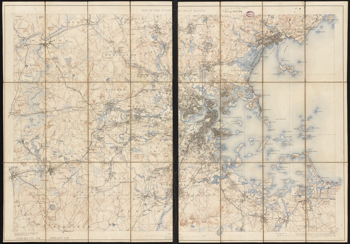
The Appalachian Mountain Club (AMC), an organization of outdoor enthusiasts, was founded in Boston in 1876. Charles Eliot was an early member of the Club, and in 1890 was elected Councilor of Topography – the same year he petitioned his fellow members to discuss the notion of The Trustees of Public Reservations. The map displayed here was published under Eliot's guidance, and used topographic maps produced by government agencies to illustrate the varied terrain surrounding Boston. Eliot and the AMC continued with their conservation efforts, and in 1892 established the Metropolitan Park Commission, the nation's first regional park system.
- Creator:
- Appalachian Mountain Club
- Date:
-
1890
- Format:
-
Maps/Atlases
- Location:
-
Boston Public Library
Norman B. Leventhal Map Center - Collection (local):
-
Norman B. Leventhal Map Center Collection
- Subjects:
-
Boston (Mass.)--Maps, Topographic
- Places:
-
Suffolk (county)Boston
- Extent:
- 1 map : col. ; 56 x 83 cm.
- Terms of Use:
-
No known copyright restrictions.
No known restrictions on use.
- Publisher:
-
[Boston, Mass.] :
Published by the Appalachian Mountain Club from the proofs of the State map with the permission of the director of the United States Geological Survey and the Commissioners of the Topographic Survey of Massachusetts
- Scale:
-
Scale 1:62,500
- Language:
-
English
- Notes:
-
Shows roads, streets and railroads.
Relief shown by contours.
- Notes (exhibitions):
-
Exhibited: "From the Sea to the Mountains: The Trustees 125th Anniversary" organized by the Norman B. Leventhal Map Center at the Boston Public Library, 2016.
- Identifier:
-
06_01_002681
- Call #:
-
G3764.B6A1 1890 .A6
- Barcode:
-
39999058997139


