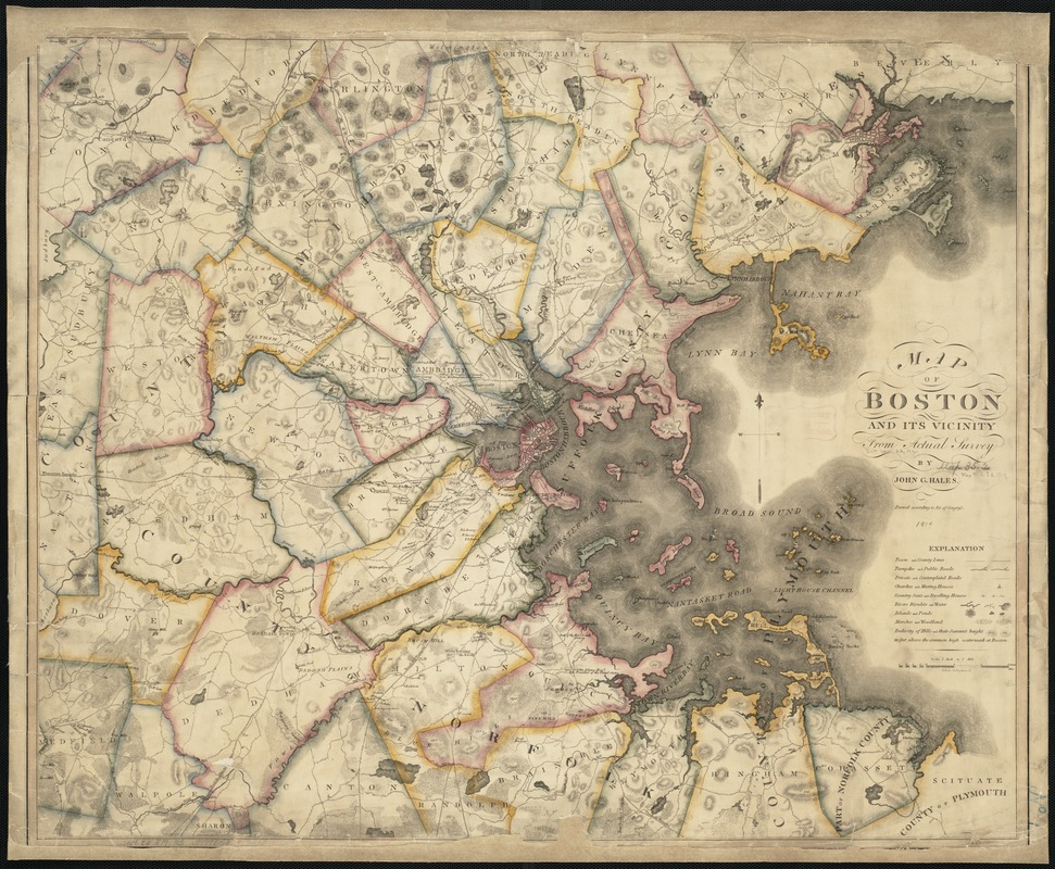
Map of Boston and its vicinity from actual survey
Item Information
- Title:
- Map of Boston and its vicinity from actual survey
- Engraver:
- Gillingham, Edwin
- Creator:
- Hales, John Groves
- Name on Item:
-
by John G. Hales.
- Date:
-
1819
- Format:
-
Maps/Atlases
- Location:
-
Boston Public Library
Norman B. Leventhal Map Center - Collection (local):
-
Norman B. Leventhal Map Center Collection
- Subjects:
-
Real property--Massachusetts--Boston--Maps
Boston (Mass.)--Maps
- Places:
-
MassachusettsSuffolk (county)Boston
- Extent:
- 1 map : col. ; 62 x 76 cm.
- Terms of Use:
-
No known copyright restrictions.
No known restrictions on use.
- Publisher:
-
Boston, Mass :
John G. Hales
- Scale:
-
Scale [1:63,360].
- Language:
-
English
- Notes:
-
Engraved by Edwin Gillingham.
Relief shown by hachures and spot heights.
Shows dwellings, identifying some occupants.
- Identifier:
-
06_01_003302
- Call #:
-
G3764.B6 1819 .H3
- Barcode:
-
39999058996818


