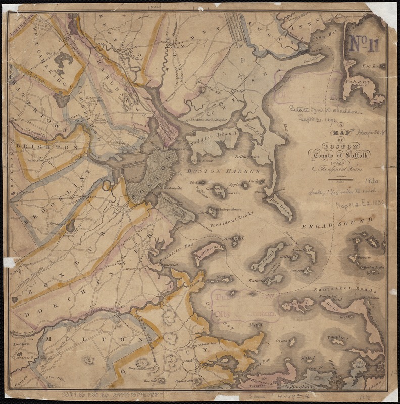
A map of Boston, county of Suffolk and the adjacent towns
Item Information
- Title:
- A map of Boston, county of Suffolk and the adjacent towns
- Creator:
- Bowen, Abel, 1790-1850
- Name on Item:
-
A. Bowen, sc.
- Date:
-
[1830]
- Format:
-
Maps/Atlases
- Location:
-
Boston Public Library
Norman B. Leventhal Map Center - Collection (local):
-
Norman B. Leventhal Map Center Collection
- Subjects:
-
Boston (Mass.)--Maps
Massachusetts--Maps
- Places:
-
Suffolk (county)Boston
- Extent:
- 1 map : col. ; 31 x 31 cm.
- Terms of Use:
-
No known copyright restrictions.
No known restrictions on use.
- Publisher:
-
S.l :
s.n.
- Scale:
-
Scale [ca. 1:79,200].
- Language:
-
English
- Notes:
-
Relief shown by hachures.
- Notes (date):
-
This date is inferred.
- Identifier:
-
06_01_002658
- Call #:
-
G3764.B4 1830 .B6
- Barcode:
-
39999058996768


![[Boston and Northwestern Junction Railroad]](https://bpldcassets.blob.core.windows.net/derivatives/images/commonwealth:x059cc74n/image_thumbnail_300.jpg)

