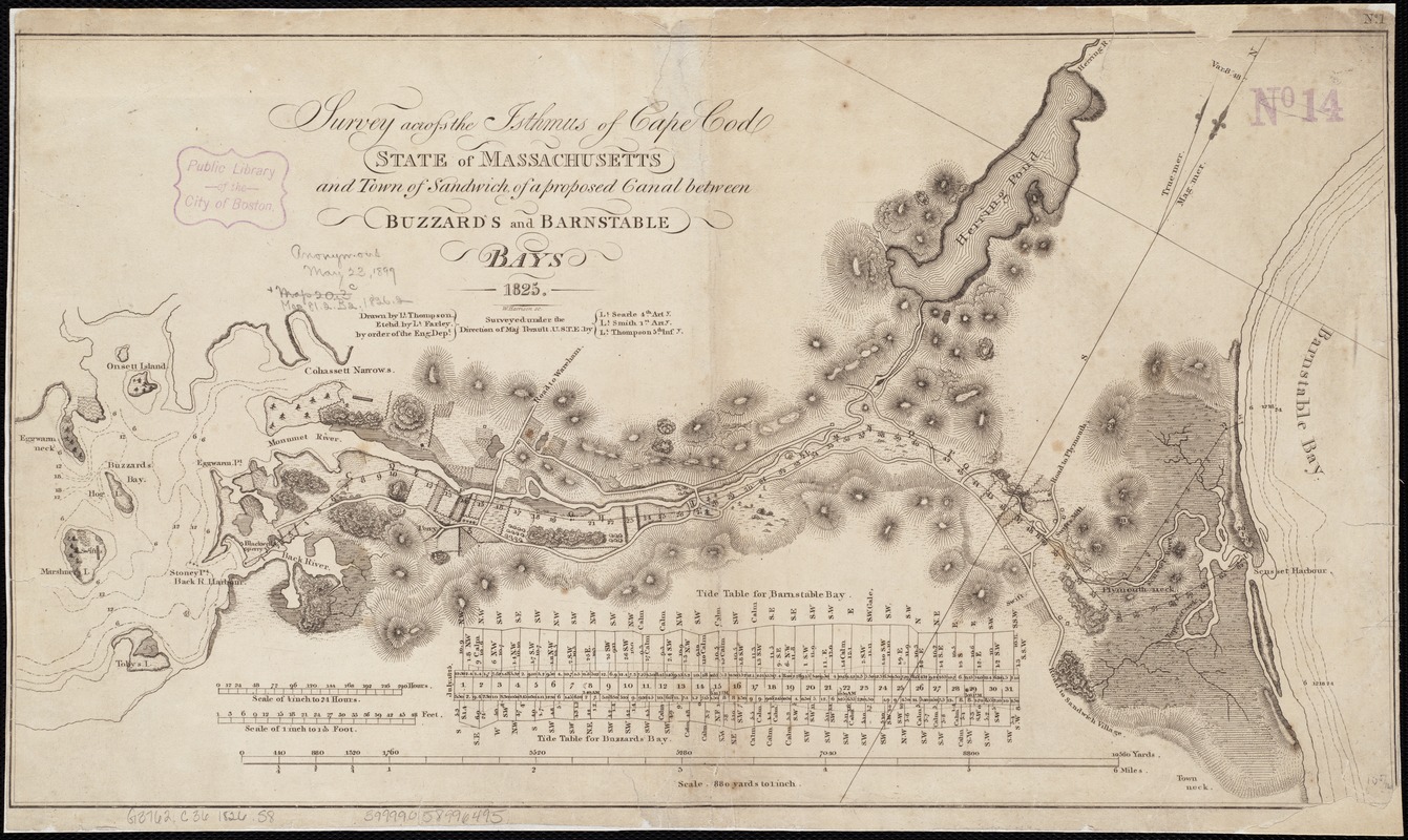
Survey across the isthmus of Cape Cod, state of Massachusetts and town of Sandwich of a proposed canal between Buzzard's and Barnstable Bays 1825
Item Information
- Title:
- Survey across the isthmus of Cape Cod, state of Massachusetts and town of Sandwich of a proposed canal between Buzzard's and Barnstable Bays 1825
- Creator:
- Thompson, William Beverhout, 1804 or 5-1867
- Name on Item:
-
drawn by Lt. Thompson ; etchd. by Lt. Farley by order of the Eng. Dept. ; surveyed under the direction of Maj. Perault U.S.T.E. by Lt. Searle ... Lt. Smith ... Lt. Thompson ; W. Harrison sc.
- Date:
-
[1826]
- Format:
-
Maps/Atlases
- Location:
-
Boston Public Library
Norman B. Leventhal Map Center - Collection (local):
-
Norman B. Leventhal Map Center Collection
- Subjects:
-
Canals--Massachusetts--Cape Cod--Maps
Cape Cod Canal (Mass.)--Maps
- Places:
-
Cape Cod Canal
- Extent:
- 1 map ; 26 x 47 cm.
- Terms of Use:
-
No known copyright restrictions.
No known restrictions on use.
- Publisher:
-
Washington, D.C.? :
s.n.
- Scale:
-
Scale ca. 31,680.
- Language:
-
English
- Notes:
-
Oriented with north toward the upper right.
Relief shown by hachures.
In upper right margin: "No. 1."
Appears in House Doc. no.174. 19th Congress, 1st session.
Includes tide table.
- Notes (date):
-
This date is inferred.
- Identifier:
-
06_01_002635
- Call #:
-
G3762.C36 1826 .T5
- Barcode:
-
39999058996495


