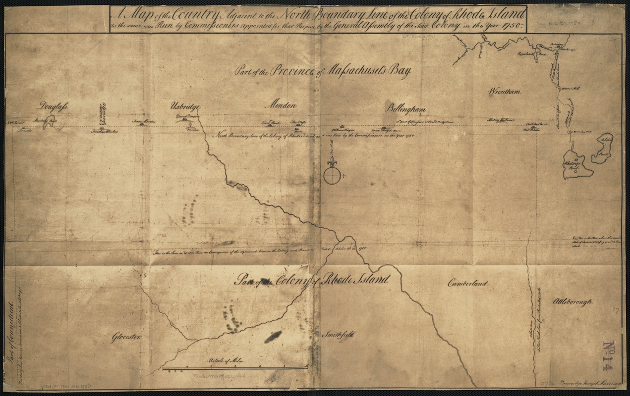
A map of the country adjacent to the north boundary line of the colony of Rhode Island as the same was run by commissioners appointed for that purpose by the general assembly of the said colony in the year 1750
This map is also available in American Revolutionary Geographies Online (ARGO), a collections portal especially built for material relating to the American Revolutionary War Era. Visit ARGO to learn more about this item and explore the historical geography of North America in the late eighteenth century.
Item Information
- Title:
- A map of the country adjacent to the north boundary line of the colony of Rhode Island as the same was run by commissioners appointed for that purpose by the general assembly of the said colony in the year 1750
- Creator:
- Harrison, Joseph.
- Name on Item:
-
drawn by Joseph Harrison.
- Date:
-
[1880?–1889?]
- Format:
-
Maps/Atlases
Manuscripts
- Location:
-
Boston Public Library
Norman B. Leventhal Map Center - Collection (local):
-
Norman B. Leventhal Map Center Collection
- Subjects:
-
Massachusetts--Maps--Early works to 1800
Rhode Island--Maps--Early works to 1800
- Places:
-
Massachusetts
Rhode Island
- Extent:
- 1 ms. map ; 43 x 70 cm.
- Terms of Use:
-
No known copyright restrictions.
No known restrictions on use.
- Scale:
-
Scale [ca. 1:59,000]
- Language:
-
English
- Notes:
-
Facsimile of manuscript map.
The original is in the office of the Secretary of State of Rhode Island.
Depicts the towns of Douglass [sic], Uxbridge, Mendon, Bellingham, Wrentham and Attleborough [sic] in part of the Province of Massachusets [sic] Bay.
Original version: 1750.
- Identifier:
-
06_01_002624
- Call #:
-
G3761.F1 1750 .H3 1880
- Barcode:
-
39999058996321

![[Coast of New England from Chatham Harbor to Naragansett Bay]](https://bpldcassets.blob.core.windows.net/derivatives/images/commonwealth:7h149x27g/image_thumbnail_300.jpg)
![[Coast of New England from Chatham Harbor to Naragansett Bay]](https://bpldcassets.blob.core.windows.net/derivatives/images/commonwealth:7h149z37x/image_thumbnail_300.jpg)

