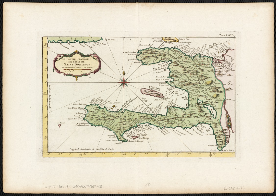
La partie Francoise de l'isle de Saint Domingue
This map is also available in American Revolutionary Geographies Online (ARGO), a collections portal especially built for material relating to the American Revolutionary War Era. Visit ARGO to learn more about this item and explore the historical geography of North America in the late eighteenth century.
Item Information
- Title:
- La partie Francoise de l'isle de Saint Domingue
- Creator:
- Bellin, Jacques Nicolas, 1703-1772
- Date:
-
[1764]
- Format:
-
Maps/Atlases
- Location:
-
Boston Public Library
Norman B. Leventhal Map Center - Collection (local):
-
Norman B. Leventhal Map Center Collection
- Subjects:
-
Nautical charts--Haiti--Early works to 1800
Nautical charts--Hispaniola--Early works to 1800
Haiti--Maps--Early works to 1800
Hispaniola--Maps--Early works to 1800
- Places:
-
Haiti
Hispaniola (island)
- Extent:
- 1 map : col. ; 21 x 34 cm.
- Terms of Use:
-
No known copyright restrictions.
No known restrictions on use.
- Publisher:
-
Paris :
Bellin
- Scale:
-
Scale not given.
- Language:
-
French
- Notes:
-
Relief shown pictorially.
Depth shown by soundings.
Appears in Bellin's Le petit atlas maritime. Paris, 1764.
"Tome I. No. 67."
- Notes (date):
-
This date is inferred.
- Identifier:
-
06_01_002594
- Call #:
-
G4940 1764 .B4
- Barcode:
-
39999058995943