Geological map of Massachusetts
Item Information
- Title:
- Geological map of Massachusetts
- Title (alt.):
-
American journal of science and arts
- Description:
-
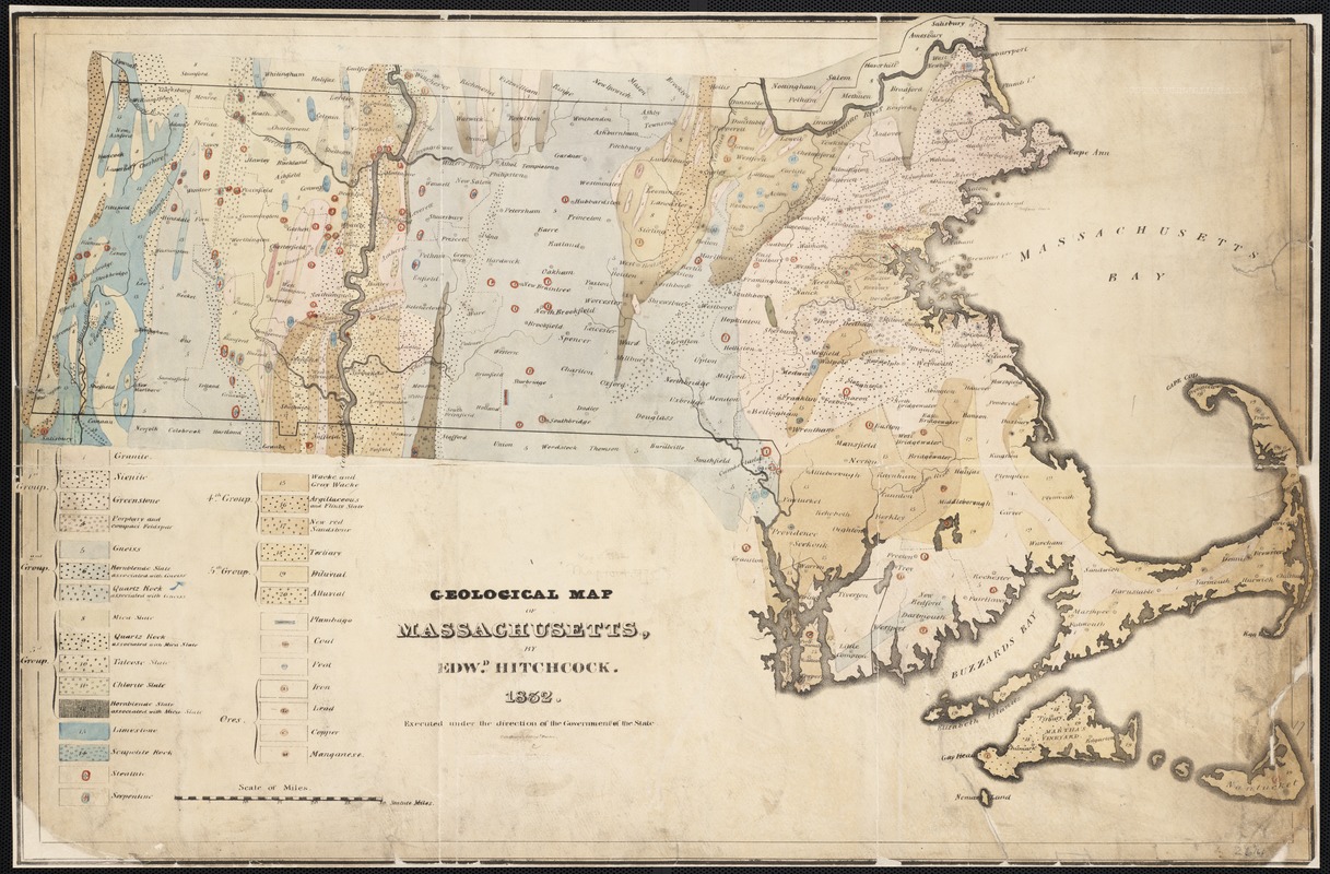
By the 1830s and 1840s, numerous eastern states throughout the country had established formal geological surveys to investigate their mineral resources. Edward Hitchcock became Massachusetts’ first state geologist in 1830, and two years later produced this map while serving in that role. Hitchcock not only used color to differentiate between rock formations and minerals, but also used symbols within major rock groups to illustrate finer levels of detail. Hitchcock taught natural sciences at Amherst College, and focused much of his research on the Connecticut River Valley, as evidenced by the thorough execution of geologic information in that area on the map.
- Creator:
- Hitchcock, Edward, 1793-1864
- Name on Item:
-
by Edwd. Hitchcock ; executed under the direction of the Government of the State.
- Date:
-
[1832]
- Format:
-
Maps/Atlases
- Location:
-
Boston Public Library
Norman B. Leventhal Map Center - Collection (local):
-
Norman B. Leventhal Map Center Collection
- Subjects:
-
Geology--Massachusetts--Maps
Massachusetts--Maps
- Places:
-
Massachusetts
- Extent:
- 1 map : hand col. ; 46 x 71 cm.
- Terms of Use:
-
No known copyright restrictions.
No known restrictions on use.
- Publisher:
-
New Haven, Conn :
Hezekiah Howe & Co. ; A.H. Maltby
- Scale:
-
Scale [ca. 1:422,400]
- Language:
-
English
- Notes:
-
Appears in: Prof. Hitchcock's Report to the Government of Massachusetts on the geology of that state; issued in: The American Journal of Science and Arts (New Haven, Conn.), v. 22 (1832).
"Pendleton's Lithog[raph]y Boston."
- Notes (date):
-
This date is inferred.
- Notes (exhibitions):
-
Exhibited: "Beneath Our Feet: Mapping the World Below" organized by the Norman B. Leventhal Map Center at the Boston Public Library, 2017-2018.
- Identifier:
-
06_01_002582
- Call #:
-
G3761.C5 1832 .H6
- Barcode:
-
39999058995786


