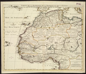
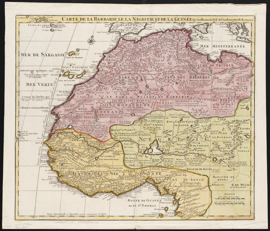
Carte de la Barbarie le la Nigritie et de la Guinée
Item Information
- Title:
- Carte de la Barbarie le la Nigritie et de la Guinée
- Title (alt.):
-
Carte de la Barbarie de la Nigritie et de la Guinée
- Creator:
- L'Isle, Guillaume de, 1675-1726
- Name on Item:
-
par Guillaume de L'Isle.
- Date:
-
[1707]
- Format:
-
Maps/Atlases
- Location:
-
Boston Public Library
Norman B. Leventhal Map Center - Collection (local):
-
Norman B. Leventhal Map Center Collection
- Subjects:
-
Africa--Maps--Early works to 1800
Africa, West--Maps--Early works to 1800
- Places:
-
Africa
West Africa (area)
- Extent:
- 1 map : col. ; 50 x 58 cm.
- Terms of Use:
-
No known copyright restrictions.
No known restrictions on use.
- Publisher:
-
Paris :
s.n.
- Scale:
-
Scale ca. 1:9,150,000.
- Language:
-
French
- Notes:
-
Relief shown pictorially.
- Notes (date):
-
This date is inferred.
- Identifier:
-
06_01_002573
- Call #:
-
G8200 1707 .L5
- Barcode:
-
39999058995711