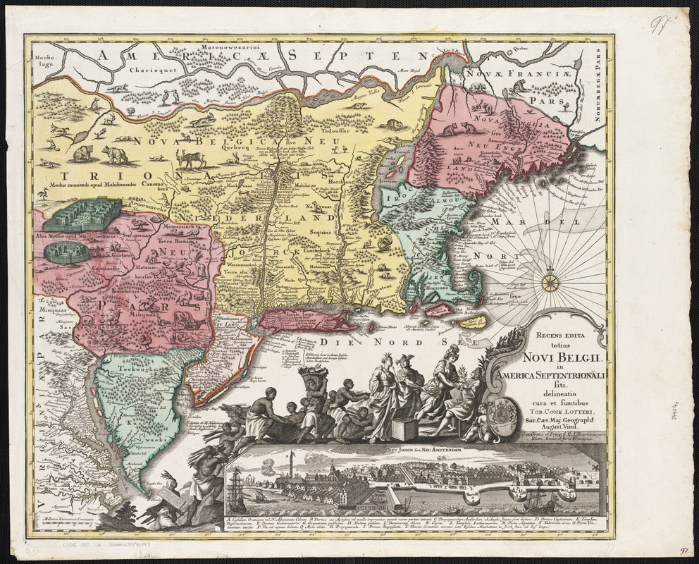
Recens edita totius Novi Belgii, in America Septentrionali siti
This map is also available in American Revolutionary Geographies Online (ARGO), a collections portal especially built for material relating to the American Revolutionary War Era. Visit ARGO to learn more about this item and explore the historical geography of North America in the late eighteenth century.
Item Information
- Title:
- Recens edita totius Novi Belgii, in America Septentrionali siti
- Creator:
- Lotter, Tobias Conrad, 1717-1777
- Name on Item:
-
delineatio cura et sumptibus Tob. Conr. Lotter Sac. Caes. Maj. Geographi August. Vind.
- Date:
-
[1757–1777]
- Format:
-
Maps/Atlases
- Location:
-
Boston Public Library
Norman B. Leventhal Map Center - Collection (local):
-
Norman B. Leventhal Map Center Collection
- Subjects:
-
East (U.S.)--Maps--Early works to 1800
- Places:
-
Eastern United States (area)
- Extent:
- 1 map : col. ; 48 x 56 cm.
- Terms of Use:
-
No known copyright restrictions.
No known restrictions on use.
- Publisher:
-
Augsburg :
Lotter
- Scale:
-
Scale not given.
- Language:
-
Latin
German
- Notes:
-
Relief shown pictorially.
Includes ill. and inset of Neu Jorck sive Neu Amsterdam.
"Cum Gratia et Privil. S.R.I. Vicariat in part, Rheni, Sveviae, et Juris Franconici."
- Notes (date):
-
This date is inferred.
- Identifier:
-
06_01_002548
- Call #:
-
G3715 1757 .L6
- Barcode:
-
39999058995497