Military map of part of Louisiana
Item Information
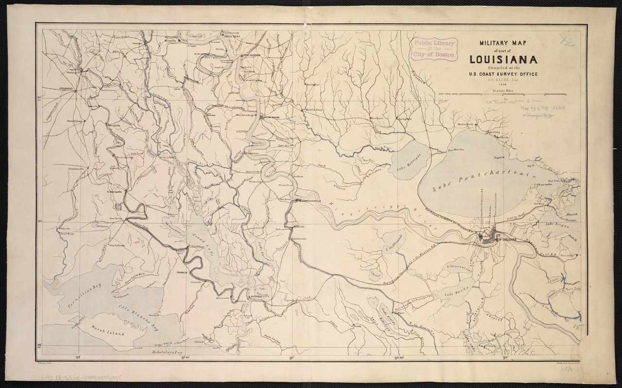
- Title:
- Military map of part of Louisiana
- Creator:
- Lindenkohl, H. (Henry)
- Name on Item:
-
Compiled at the U.S. Coast Survey Office, A.D. Bache ; drawn by H. Lindenkohl ; E. Molitor, lith.
- Date:
-
[1863]
- Format:
-
Maps/Atlases
- Location:
-
Boston Public Library
Norman B. Leventhal Map Center - Collection (local):
-
Norman B. Leventhal Map Center Collection
- Subjects:
-
Louisiana--Maps
- Places:
-
Louisiana
- Extent:
- 1 map : col. ; 40 x 66 cm.
- Terms of Use:
-
No known copyright restrictions.
No known restrictions on use.
- Publisher:
-
S.l :
U.S. Coast Survey Office
- Scale:
-
Scale ca. 1:390,000.
- Language:
-
English
- Notes:
-
General map of southern Louisiana from St. Francisville south to Atchafalaya Bay and Lake Borgne west to Vermilion Bay.
Description derived from published bibliography.
- Notes (date):
-
This date is inferred.
- Identifier:
-
06_01_002458
- Call #:
-
G4011.R2 1863 .L5
- Barcode:
-
39999058994995
- LCCN:
-
99447190


