Map of a part of Louisiana and Mississippi, illustrating the operations of the U.S. Forces in the Department of the Gulf
Item Information
- Title:
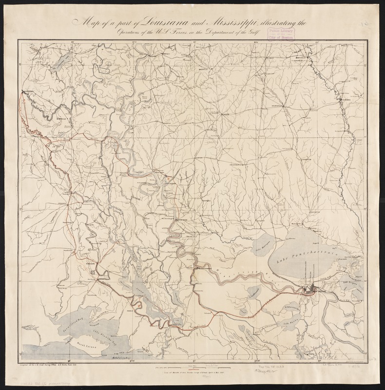
- Map of a part of Louisiana and Mississippi, illustrating the operations of the U.S. Forces in the Department of the Gulf
- Creator:
- Lindenkohl, H. (Henry)
- Name on Item:
-
drawn by H. Lindenkohl ; compiled at the U.S. Coast Survey Office.
- Date:
-
[1863]
- Format:
-
Maps/Atlases
- Location:
-
Boston Public Library
Norman B. Leventhal Map Center - Collection (local):
-
Norman B. Leventhal Map Center Collection
- Subjects:
-
Louisiana--Maps
Mississippi--Maps
- Places:
-
Louisiana
Mississippi
- Extent:
- 1 map : col. ; 65 x 70 cm.
- Terms of Use:
-
No known copyright restrictions.
No known restrictions on use.
- Publisher:
-
S.l :
U.S. Coast Survey Office
- Scale:
-
Scale [ca. 1:380,000]
- Language:
-
English
- Notes:
-
Line of marsh [sic] of Gen. Banks corps d'armée April & Mai 1863.
Roads, railroads, drainage and towns are shown.
- Notes (date):
-
This date is inferred.
- Identifier:
-
06_01_002457
- Call #:
-
G4011.R3 1863 .L5
- Barcode:
-
39999058994961


