Charles River : carries shown by red lines
Item Information
- Title:
- Charles River : carries shown by red lines
- Description:
-
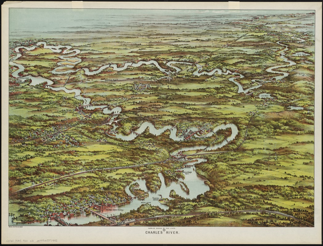
The Boston Marathon route runs 26 miles from Hopkinton to the Boston finish line; the meandering Charles River winds 80 miles between those same points, flowing through 23 communities before emptying into Boston Harbor. This bird’s-eye view, produced in the early 20th century, looks southwest from an imaginary vantage point above the industrial city of Waltham. The river snakes through the western suburbs, passing such landmarks as the Waltham Watch Factory, the industrial complex at Newton Lower Falls, and the now-defunct Norumbega Park. Rail lines crisscross the landscape, evidence of the growth of these river-adjacent towns.
- Creator:
- Walker Lith. & Pub. Co
- Date:
-
[1900?]
- Format:
-
Maps/Atlases
- Location:
-
Boston Public Library
Norman B. Leventhal Map Center - Collection (local):
-
Norman B. Leventhal Map Center Collection
- Subjects:
-
Railroads--Massachusetts
Charles River (Mass.)--Aerial views
- Places:
-
Charles (river)
- Extent:
- 1 view : col. ; 49 x 68 cm.
- Terms of Use:
-
No known copyright restrictions.
No known restrictions on use.
- Publisher:
-
Boston, Mass :
Walker Lith. & Pub. Co.
- Scale:
-
Not drawn to scale.
- Language:
-
English
- Notes:
-
Bird's-eye view.
Depicts the route of the Charles River and railroads throughout the western suburbs of Boston.
- Notes (exhibitions):
-
Exhibited: "Breathing Room: Mapping Boston's Green Spaces" organized by the Norman B. Leventhal Map Center at the Boston Public Library, 2018.
- Identifier:
-
06_01_002353
- Call #:
-
G3762.C5A3 1900 .W3
- Barcode:
-
39999058994185


