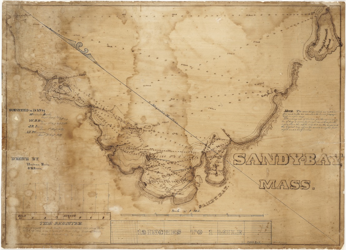
Sandy-Bay, Mass
Item Information
- Title:
- Sandy-Bay, Mass
- Description:
-
This chart documents an early survey of potential breakwater sites at Sandy Bay off Cape Ann, Massachusetts.
- Creator:
- Bache, Hartman, 1797-1872
- Name on Item:
-
surveyed in 1829 by Hartman Bache ... [et al.] ; drawn by Hartman Bache and J.R. Irwin.
- Date:
-
1829
- Format:
-
Maps/Atlases
Manuscripts
- Location:
-
Boston Public Library
Norman B. Leventhal Map Center - Collection (local):
-
Norman B. Leventhal Map Center Collection
- Subjects:
-
Nautical charts--Massachusetts--Rockport
Rockport (Mass.)--Maps, Manuscript
Sandy Bay (Mass.)--Maps, Manuscript
- Places:
-
Essex (county)Sandy Bay
Essex (county)Rockport
- Extent:
- 1 ms. chart ; 51 x 73 cm.
- Terms of Use:
-
No known copyright restrictions.
No known restrictions on use.
- Scale:
-
Scale 1:5,280.
- Language:
-
English
- Notes:
-
Depths shown by soundings.
Manuscript chart of Sandy Bay (Rockport), Massachusetts.
"The soundings, which are noted in feet and inches are reduced to the lowest tides registered in eight days..."
"Copy of report of Capt. Bache accompanying this place dated April 1st 1830, is on file in U.S. Engr. Office, Boston, Msss. H. of R. at Sandy Bay, #12, 1883."
- Identifier:
-
06_01_002321
- Call #:
-
G3764.R7 1829 .B3
- Barcode:
-
39999058993971


