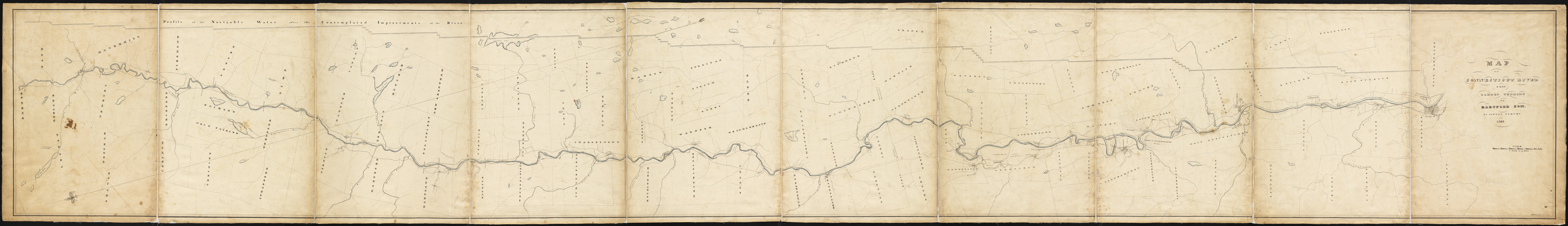
Map of Connecticut River from Barnet Vermont to Hartford Con : by actual survey in 1825
Item Information
- Title:
- Map of Connecticut River from Barnet Vermont to Hartford Con : by actual survey in 1825
- Title (alt.):
-
Report of the President and Directors of the Connecticut River Company, with the report of H. Hutchinson Esq. laid before the stockholders
- Creator:
- Dunbar, E.
- Name on Item:
-
E. Dunbar Survr. & Delr.
- Date:
-
1825
- Format:
-
Maps/Atlases
- Location:
-
Boston Public Library
Norman B. Leventhal Map Center - Collection (local):
-
Norman B. Leventhal Map Center Collection
- Subjects:
-
Connecticut River--Maps, Manuscript
- Places:
-
Connecticut (river)
- Extent:
- 1 ms. map : col. ; 62 x 472 cm. + 1 booklet (54 p.)
- Terms of Use:
-
No known copyright restrictions.
No known restrictions on use.
- Scale:
-
Scale ca. 1:63,360
- Language:
-
English
- Notes:
-
Includes profile of the navigable water after the contemplated improvements of the river.
Includes accompanying booklet: Report of the President and DIrectors of the Connecticut River Company, with the report of H. Hutchinson, Esq. laid before the stockholders. At their annual meeting, January 3d, 1826.
- Identifier:
-
06_01_002298
- Call #:
-
G1212.C62 .D8 1825
- Barcode:
-
39999058993740


