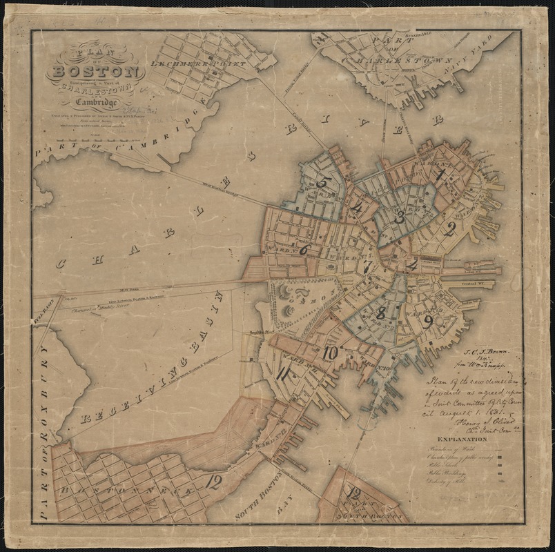
Plan of Boston comprising a part of Charlestown and Cambridge
Item Information
- Title:
- Plan of Boston comprising a part of Charlestown and Cambridge
- Creator:
- Fuller, Stephen P.
- Name on Item:
-
engraved & published by Annin & Smith & J.V.N. Throop from actual survey ; with corrections by S.P. Fuller, surveyor.
- Date:
-
1826
- Format:
-
Maps/Atlases
- Location:
-
Boston Public Library
Norman B. Leventhal Map Center - Collection (local):
-
Norman B. Leventhal Map Center Collection
- Subjects:
-
Boston (Mass.)--Maps
- Places:
-
Suffolk (county)Boston
- Extent:
- 1 map : hand col. ; 54 x 53 cm.
- Terms of Use:
-
No known copyright restrictions.
No known restrictions on use.
- Publisher:
-
Boston :
Annin & Smith ; J.V.N. Throop
- Scale:
-
Scale [ca. 1:6,090].
- Language:
-
English
- Notes:
-
Existing wards numbered and outlined by dotted lines.
Colored to show proposed new wards.
Relief shown by hachures.
- Identifier:
-
06_01_001281
- Call #:
-
G3764.B6 1826 .F8
- Barcode:
-
39999058994987


