A map of the towns of Dorchester and Milton, 1831
Item Information
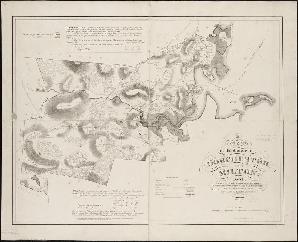
- Title:
- A map of the towns of Dorchester and Milton, 1831
- Creator:
- Baker, Edmund J.
- Name on Item:
-
made under the direction of the Town's committees for the use of the Commonwealth, from actual surveys, made by Edmund J. Baker.
- Date:
-
1831
- Format:
-
Maps/Atlases
- Location:
-
Boston Public Library
Norman B. Leventhal Map Center - Collection (local):
-
Norman B. Leventhal Map Center Collection
- Subjects:
-
Milton (Mass.)--Maps
Dorchester (Boston, Mass.)--Maps
- Places:
-
Suffolk (county)BostonDorchester
Norfolk (county)Milton
- Extent:
- 1 map ; 61 x 80 cm.
- Terms of Use:
-
No known copyright restrictions.
No known restrictions on use.
- Publisher:
-
Boston :
Pendleton's Lith.
- Scale:
-
Scale [ca. 1:20,000]
- Language:
-
English
- Notes:
-
Relief shown by shading.
Includes index to points of interest and short description of each town.
Oriented with north towards the upper right.
- Identifier:
-
06_01_002132
- Call #:
-
G3764.B6:2D6 1831 .B3
- Barcode:
-
39999058991892


