Bird's eye view of Ishpeming, L.S. Michigan : 1871
Item Information
- Title:
- Bird's eye view of Ishpeming, L.S. Michigan : 1871
- Description:
-
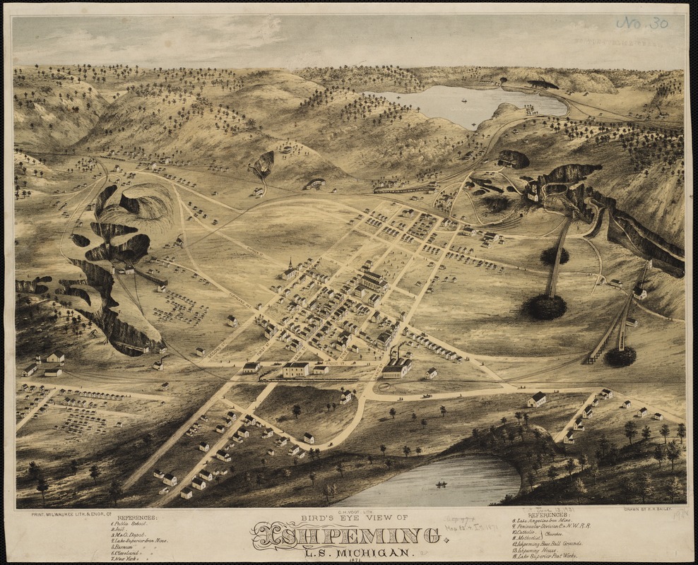
America Transformed: The Lake Superior region became the nation's major supplier of iron ore after its discovery in Michigan's Upper Peninsula in the 1840s, while reservations were established and Anishinaabe (Ojibwe) lands were ceded. This view of Ishpeming, Michigan, provides an example of an iron mining community and the effects of mining operations on the surrounding landscape. The shaded areas on the surrounding hills depict open-pit iron mines. In the foreground, a train cuts across the landscape toward one mine, while a network of railroad tracks service other mines. Laid out in 1869, the town grew rapidly, reaching a population of 6,000 by the time this view was published.
- Creator:
- Bailey, H. H. (Howard Heston), 1836-1878
- Name on Item:
-
drawn by H.H. Bailey ; C. H. Vogt Lith.
- Date:
-
[1871]
- Format:
-
Maps/Atlases
- Location:
-
Boston Public Library
Norman B. Leventhal Map Center - Collection (local):
-
Norman B. Leventhal Map Center Collection
- Subjects:
-
Ishpeming (Mich.)--Aerial views
- Places:
-
Marquette (county)Ishpeming
- Extent:
- 1 view : col. ; 37 x 51 cm.
- Terms of Use:
-
No known copyright restrictions.
No known restrictions on use.
- Publisher:
-
[Milwaukee?] :
Milwaukee Lith. & Engr. Co.
- Language:
-
English
- Notes:
-
Indexed for points of interest.
- Notes (date):
-
This date is inferred.
- Notes (exhibitions):
-
Exhibited: "America Transformed. Part 2: Homesteads to Modern Cities," organized by the Norman B. Leventhal Map & Education Center at the Boston Public Library, 2019-2020.
- Identifier:
-
06_01_001592
- Call #:
-
G4114.I8A3 1871 .B3
- Barcode:
-
39999058990373
- LCCN:
-
76697017


