Hyde Park, Massachusetts : 1890
Item Information
- Title:
- Hyde Park, Massachusetts : 1890
- Description:
-
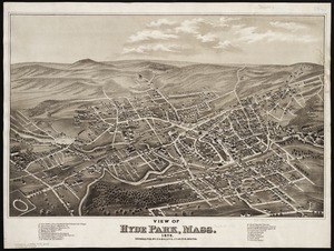
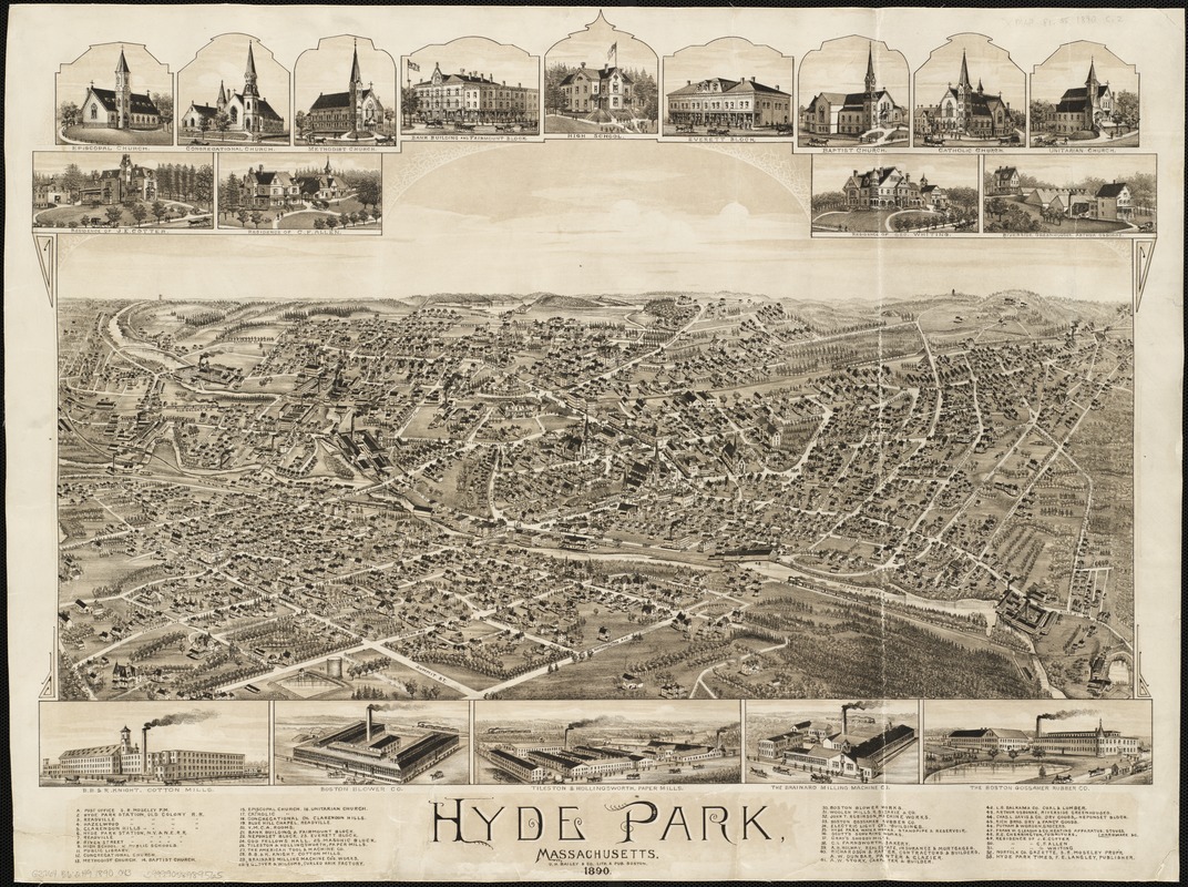
Located on the Neponset River, defining Boston's southeastern boundary, Hyde Park developed into a street car suburb of Boston during the last half of the 19th century. In this drawing, the village is viewed from the east. The artist selected a vantage point, as if he was positioned above Brush Hill looking westward across the village as it straddles the river. Besides being a residential suburb, Hyde Park had its own industrial base, with ten large factories identified in the legend, five of which were also pictured in the marginal insets. All of these are located near the river and its tributary, Mother Brook, which runs diagonally through the middle of the picture. Proximity to water power was doubtless an important consideration in determining the original location of these factories. Two railroad lines are shown running through the village, also providing access to the industrial sites. Interestingly, on both lines trains are approaching from opposite directions. It is not clear that double tracks are available before the opposing trains meet. In comparison to other communities near Boston, the town of Hyde Park was established rather late in metropolitan history. Hyde Park was incorporated as a township in 1868 by consolidating a number of small neighboring villages that were formerly part of the older towns of Dorchester, Milton, and Dedham. In 1912, Hyde Park was annexed by Boston, constituting the last major addition to the city by annexation.
- Creator:
- O.H. Bailey & Co
- Name on Item:
-
O.H. Bailey & Co., Lith. & pub.
- Date:
-
1890
- Format:
-
Maps/Atlases
- Location:
-
Boston Public Library
Norman B. Leventhal Map Center - Collection (local):
-
Norman B. Leventhal Map Center Collection
- Subjects:
-
Hyde Park (Boston, Mass.)--Aerial views
Boston (Mass.)--Aerial views
- Places:
-
Suffolk (county)BostonHyde Park
- Extent:
- 1 view : col. ; 47 x 69 cm.
- Terms of Use:
-
No known copyright restrictions.
No known restrictions on use.
- Publisher:
-
Boston :
O.H. Bailey
- Scale:
-
Not drawn to scale.
- Language:
-
English
- Notes:
-
Indexed for points of interest.
Includes ill.
Bird's-eye view.
- Notes (exhibitions):
-
Exhibited: "Boston & Beyond: A Bird’s Eye View of New England" organized by the Norman B. Leventhal Map Center at the Boston Public Library, 2008.
- Identifier:
-
06_01_001570
- Call #:
-
G3764.B6:2H9A3 1890 .O43
- Barcode:
-
39999058989565