A new plan of Boston : drawn from the best authorities with the latest improvements, additionas and corrections
Item Information
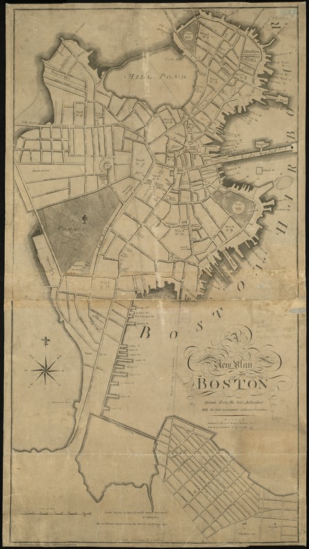
- Title:
- A new plan of Boston : drawn from the best authorities with the latest improvements, additionas and corrections
- Creator:
- Norman, William, d. 1807
- Date:
-
1806
- Format:
-
Maps/Atlases
- Location:
-
Boston Public Library
Norman B. Leventhal Map Center - Collection (local):
-
Norman B. Leventhal Map Center Collection
- Subjects:
-
Boston (Mass.)--Maps
- Places:
-
Suffolk (county)Boston
- Extent:
- 1 map ; 90 x 48 cm.
- Terms of Use:
-
No known copyright restrictions.
No known restrictions on use.
- Publisher:
-
Boston :
Sold by W. Norman ; sold also by Wm. Pelham
- Scale:
-
Scale [ca. 1:4,200]
- Language:
-
English
- Notes:
-
South Boston is taken from actual surveys of Mr. Withington.
Relief shown by hachures.
- Identifier:
-
06_01_001077
- Call #:
-
G3764.B6 1806 .N67
- Barcode:
-
39999052508916


