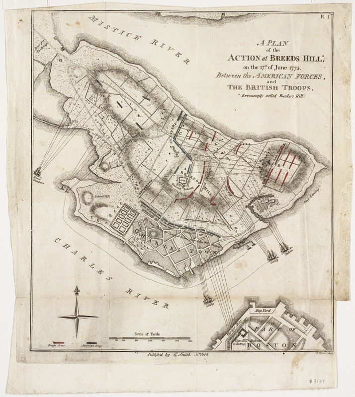
A plan of the action at Breeds Hill, on the 17th of June 1775 : between the American forces and the British troops : erroneously called Bunkers Hill
This map is also available in American Revolutionary Geographies Online (ARGO), a collections portal especially built for material relating to the American Revolutionary War Era. Visit ARGO to learn more about this item and explore the historical geography of North America in the late eighteenth century.
Item Information
- Title:
- A plan of the action at Breeds Hill, on the 17th of June 1775 : between the American forces and the British troops : erroneously called Bunkers Hill
- Creator:
- Smith, Charles, 1768-1808
- Name on Item:
-
D. Martin, sculp.
- Date:
-
[1797]
- Format:
-
Maps/Atlases
- Location:
-
Boston Public Library
Norman B. Leventhal Map Center - Collection (local):
-
Norman B. Leventhal Map Center Collection
- Subjects:
-
Bunker Hill, Battle of, Boston, Mass., 1775--Maps--Early works to 1800
Boston (Mass.)--History--Revolution, 1775-1783--Maps--Early works to 1800
- Places:
-
Suffolk (county)BostonBunker Hill
- Extent:
- 1 map : col. ; 23 x 20 cm.
- Terms of Use:
-
No known copyright restrictions.
No known restrictions on use.
- Publisher:
-
New York :
C. Smith
- Scale:
-
Scale not given.
- Language:
-
English
- Notes:
-
Relief shown by hachures.
Depicts the lines of march of attacking forces, British ships and the Corps Hill Battery with lines of fire.
- Notes (date):
-
This date is inferred.
- Identifier:
-
06_01_000882
- Call #:
-
G3764.B6:2C38S3 1797 .S65
- Barcode:
-
39999052508908


