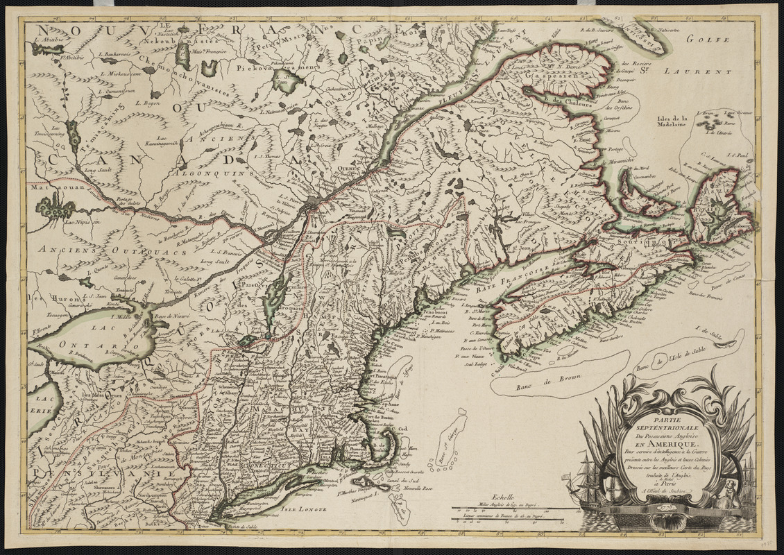
Partie septentrionale des possessions Angloise en Amerique : pour servire d'intelligence à la guerre présente entre les Anglios et leurs Colonies
This map is also available in American Revolutionary Geographies Online (ARGO), a collections portal especially built for material relating to the American Revolutionary War Era. Visit ARGO to learn more about this item and explore the historical geography of North America in the late eighteenth century.
Item Information
- Title:
- Partie septentrionale des possessions Angloise en Amerique : pour servire d'intelligence à la guerre présente entre les Anglios et leurs Colonies
- Description:
-
Focusing on the northern part of the English colonies in North America, this map was prepared to inform the French public of the “present war between the English and their colonies.” It was compiled by selecting and translating information from various British maps of the colonies.
- Translator:
- Michel
- Name on Item:
-
dressée sur les meilleurs carte du pays traduite de l'Angliose
- Date:
-
1778
- Format:
-
Maps/Atlases
- Location:
- Private Collection
- Collection (local):
-
Mapping Boston Collection
- Subjects:
-
Atlantic Provinces--Maps--Early works to 1800
Atlantic Coast (U.S.)--Maps--Early works to 1800
Maritime Provinces--Maps--Early works to 1800
New England--Maps--Early works to 1800
- Places:
-
New England (area)
CanadaProvince of Prince Edward Island (province)
- Extent:
- 1 map : col. ; 51 x 72 cm.
- Terms of Use:
-
No known copyright restrictions.
This work is licensed for use under a Creative Commons Attribution Non-Commercial Share Alike License (CC BY-NC-SA).

- Publisher:
-
Paris :
de Michel à Paris a l'Hôtel de Soubise
- Scale:
-
Scale not given
- Language:
-
French
- Notes:
-
Relief shown pictorially.
- Identifier:
-
06_01_001154
- Barcode:
-
39999052508700


