Map of Massachusetts proper
Item Information
- Title:
- Map of Massachusetts proper
- Description:
-
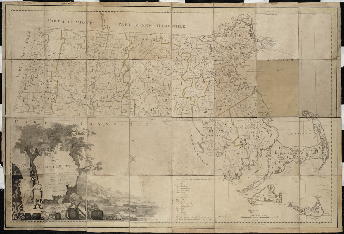
While this is the earliest official state map of Massachusetts, its importance far exceeds its local interest. It was also one of the earliest state maps published after American independence and its compilation provided a model for other states. Carleton, a highly respected Boston mathematician and geographer, proposed this project in 1791. The state legislature sanctioned his proposal on June 18, 1794, when it passed a resolution directing the selectmen of every town to prepare a survey. By June 1795, 265 town maps had been submitted, from which Carleton compiled a single comprehensive map of the state.
- Creator:
- Carleton, Osgood, 1742-1816
- Contributor:
- Callender, Joseph, 1751-1821
- Contributor:
- Graham, George, fl. 1788-1813
- Contributor:
- Hill, Samuel, approximately 1766-1804
- Name on Item:
-
compiled from actual surveys made by order of the General Court, and under the inspection of agents of their appointment ; by Osgood Carelton ; engraved by Joseph Callender and Samuel Hill ; vignette drawn by G. Graham
- Date:
-
1801
- Format:
-
Maps/Atlases
- Location:
- Private Collection
- Collection (local):
-
Mapping Boston Collection
- Subjects:
-
Massachusetts--Maps
- Places:
-
Massachusetts
- Extent:
- 1 map : col. ; 76 x 114 cm.
- Terms of Use:
-
No known copyright restrictions.
This work is licensed for use under a Creative Commons Attribution Non-Commercial Share Alike License (CC BY-NC-SA).

- Publisher:
-
Boston :
[B. & J. Loring]
- Scale:
-
Scale 1:253,000
- Language:
-
English
- Notes:
-
Shows distance of each town from Boston and the shire town.
- Identifier:
-
06_01_001217
- Barcode:
-
39999052508494


