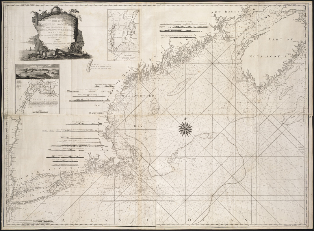
A new and correct chart of the coast of New England and New York with the adjacent parts of Nova Scotia and New Brunswick from Cape Sable to the entrance of Hudsons or North River
This map is also available in American Revolutionary Geographies Online (ARGO), a collections portal especially built for material relating to the American Revolutionary War Era. Visit ARGO to learn more about this item and explore the historical geography of North America in the late eighteenth century.
Item Information
- Title:
- A new and correct chart of the coast of New England and New York with the adjacent parts of Nova Scotia and New Brunswick from Cape Sable to the entrance of Hudsons or North River
- Creator:
- Holland, Nathaniel
- Contributor:
- Huddart, Joseph, 1741-1816
- Contributor:
- Williams, W. A.
- Contributor:
- Robert Laurie and James Whittle
- Name on Item:
-
by Captain Holland
- Date:
-
1794
- Format:
-
Maps/Atlases
- Location:
- Private Collection
- Collection (local):
-
Mapping Boston Collection
- Subjects:
-
Atlantic Coast (North America)--Maps--Early works to 1800
- Places:
-
North America (area)
- Extent:
- 1 map : 106 x 145 cm.
- Terms of Use:
-
No known copyright restrictions.
This work is licensed for use under a Creative Commons Attribution Non-Commercial Share Alike License (CC BY-NC-SA).

- Publisher:
-
London :
Laurie & Whittle
- Scale:
-
Scale ca. 1:590,000
- Language:
-
English
- Notes:
-
Depths shown by soundings.
Includes numerous coastal profiles of east coast landmarks.
- Identifier:
-
06_01_001230
- Barcode:
-
39999052508486


