Plan de Boston avec les sondes et les directions pour la navigation : traduit de l'anglais
This map is also available in American Revolutionary Geographies Online (ARGO), a collections portal especially built for material relating to the American Revolutionary War Era. Visit ARGO to learn more about this item and explore the historical geography of North America in the late eighteenth century.
Item Information
- Title:
- Plan de Boston avec les sondes et les directions pour la navigation : traduit de l'anglais
- Description:
-
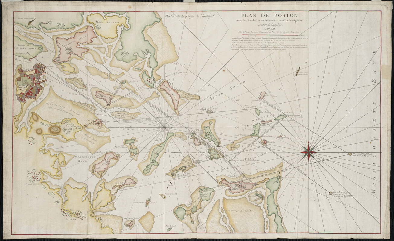
Boston and other nearby towns, many of which were depicted pictorially, are located on this French chart of Boston Bay. Boston, with city blocks colored in different shades, covers most of the peninsula. The harbor is shown with navigational information such as islands, shoals, soundings, and channels. A note following the title indicates that the chart was based on British surveys. Le Rouge, the chart's publisher, is known to have published several volumes of maps, charts, and city plans relating to America from 1755 to 1778, many of which were based on the best contemporary English maps.
- Creator:
- Le Rouge, Georges-Louis
- Date:
-
[1778]
- Format:
-
Maps/Atlases
- Location:
- Private Collection
- Collection (local):
-
Mapping Boston Collection
- Subjects:
-
Nautical charts--Massachusetts--Boston Bay--Early works to 1800
Nautical charts--Massachusetts--Boston Harbor--Early works to 1800
Boston Bay (Mass.)--Maps--Early works to 1800
Boston Harbor (Mass.)--Maps--Early works to 1800
- Places:
-
Boston Harbor
- Extent:
- 1 map : col. ; 52 x 87 cm.
- Terms of Use:
-
No known copyright restrictions.
This work is licensed for use under a Creative Commons Attribution Non-Commercial Share Alike License (CC BY-NC-SA).

- Publisher:
-
Paris :
Chez Le Rouge
- Scale:
-
Scale ca. 1:28,000
- Language:
-
French
- Notes:
-
Relief shown by hachures.
Depths shown by soundings.
Based on A Chart of the harbour of Boston, with the soundings, sailing-marks, and other directions. [1777].
From the author's Pilote Américain Septentrional. 1778-79. v. 1.
- Notes (date):
-
This date is inferred.
- Identifier:
-
06_01_001251
- Barcode:
-
39999052508460


