A new and correct chart of the sea coast of New-England from Cape Codd to Casco Bay
This map is also available in American Revolutionary Geographies Online (ARGO), a collections portal especially built for material relating to the American Revolutionary War Era. Visit ARGO to learn more about this item and explore the historical geography of North America in the late eighteenth century.
Item Information
- Title:
- A new and correct chart of the sea coast of New-England from Cape Codd to Casco Bay
- Description:
-
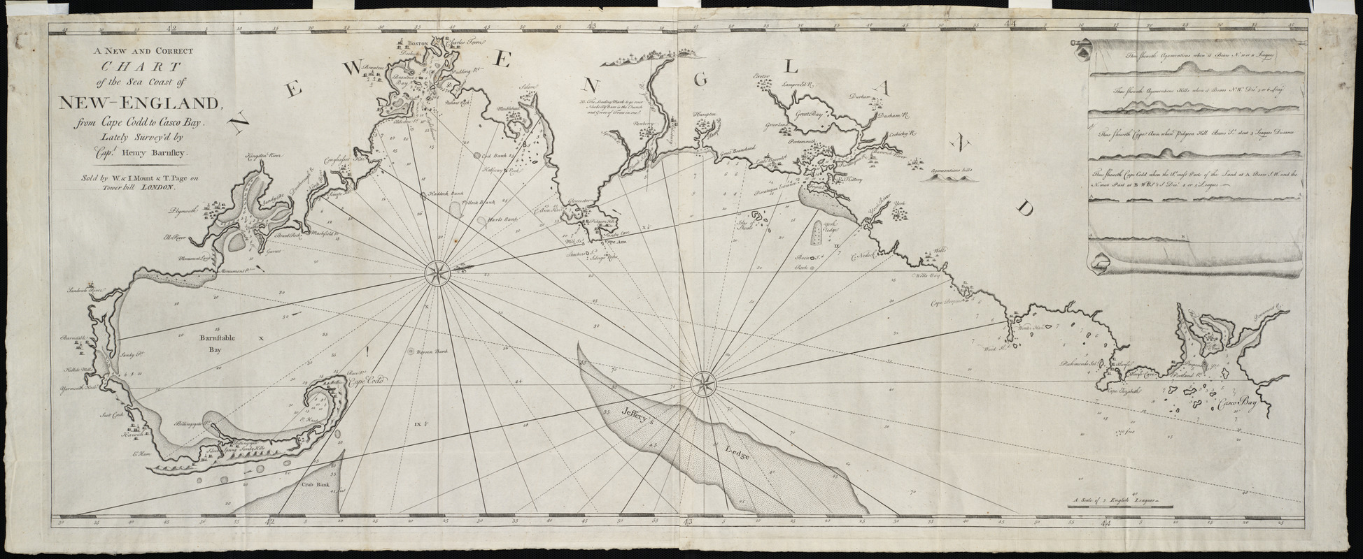
Captain Barnsley's chart of the New England coast replaced that of Cyprian Southack in the 1767 edition of The English Pilot, the standard English marine atlas throughout the eighteenth century. Oriented with north to the upper right, this chart depicts important towns and harbors along the coast from Cape Cod to Casco Bay. Of interest at the upper right are four headland views, which provided perspective views to assist captains sailing into these harbors.
- Creator:
- Barnsley, Henry
- Contributor:
- Jno. Mount and Tho. Page
- Name on Item:
-
lately survey'd by Capt. Henry Barnsley.
- Date:
-
[1767]
- Format:
-
Maps/Atlases
- Location:
- Private Collection
- Collection (local):
-
Mapping Boston Collection
- Subjects:
-
Nautical charts--Atlantic Coast (New England)--Early works to 1800
Nautical charts--New England--Early works to 1800
Atlantic Coast (New England)--Maps--Early works to 1800
- Places:
-
New England (area)
- Extent:
- 1 map ; 45 x 116 cm.
- Terms of Use:
-
No known copyright restrictions.
This work is licensed for use under a Creative Commons Attribution Non-Commercial Share Alike License (CC BY-NC-SA).

- Publisher:
-
London :
Sold by W. & I. Mount & T. Page on Tower bill
- Scale:
-
Scale [ca. 1:143,000]
- Language:
-
English
- Notes:
-
Shows settlements pictorially.
Relief shown pictorially.
Depths shown by soundings and shading.
Oriented with north toward the upper right.
Includes 5 views of coastline.
Appears in The English pilot. Fourth book. London. 1773.
- Notes (date):
-
This date is inferred.
- Identifier:
-
06_01_001212
- Barcode:
-
39999052508403


