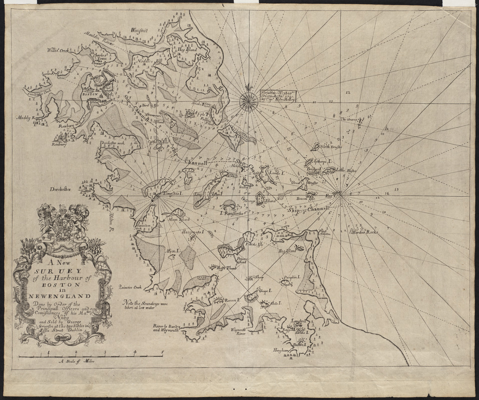
A new suruey of the harbour of Boston in New England
This map is also available in American Revolutionary Geographies Online (ARGO), a collections portal especially built for material relating to the American Revolutionary War Era. Visit ARGO to learn more about this item and explore the historical geography of North America in the late eighteenth century.
Item Information
- Title:
- A new suruey of the harbour of Boston in New England
- Title (alt.):
-
New survey of the harbour of Boston in New England
- Description:
-
This chart of Boston Harbor is a rare Irish printing that was pirated from the anonymous English chart that first appeared in Mount and Page's 1707 edition of The English Pilot, The Fourth Book, as well as their 1708 edition of Atlas Maritimus Novus. However, this chart was re-engraved and printed from a separate copper plate. Although at the time, this survey was over forty years old, it continued to function as the most accurate printed chart of Boston Harbor.
- Creator:
- Grierson, George, d. 1753
- Name on Item:
-
done by order of the principall officers and comissioners of his Ma.ties Navy and sold by George Grierson at the two bibles in Essex Street Dublin
- Date:
-
1749
- Format:
-
Maps/Atlases
- Location:
- Private Collection
- Collection (local):
-
Mapping Boston Collection
- Subjects:
-
Nautical charts--Massachusetts--Boston Harbor--Early works to 1800
Boston Harbor (Mass.)--Maps--Early works to 1800
- Places:
-
Boston Harbor
- Extent:
- 1 map ; 41 x 53 cm.
- Terms of Use:
-
No known copyright restrictions.
This work is licensed for use under a Creative Commons Attribution Non-Commercial Share Alike License (CC BY-NC-SA).

- Publisher:
-
Dublin :
George Grierson
- Scale:
-
Scale not given
- Language:
-
English
- Notes:
-
Depth shown by soundings.
- Identifier:
-
06_01_001197
- Barcode:
-
39999052508569


