Novi Belgii, Novaeque Angliae nec non partis Virginiae tabula
Item Information
- Title:
- Novi Belgii, Novaeque Angliae nec non partis Virginiae tabula
- Description:
-
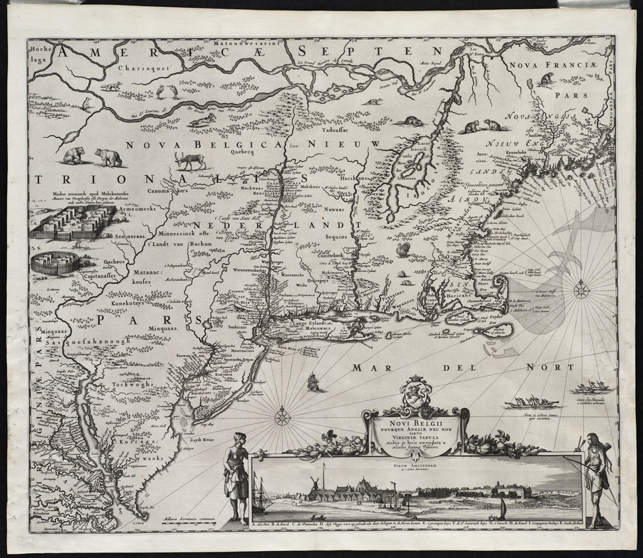
This is an early re-issue of the influential map of northeastern North America, first published by Jan Jansson in 1651. While Visscher copied much of Jansson's original map, he did invert several decorative details and added the inset view of New York City. The original map, which was a careful compilation of earlier maps by Samuel Champlain, Capt. John Smith and William Blaeu, was intended to promote Dutch colonization of New Netherlands. After English occupation of New York in 1674, the map served equally well to attract European settlers to New England.
- Creator:
- Visscher, Nicolaes, 1618-1679
- Name on Item:
-
multis in locis emendata a Nicolao Joannis Visschero
- Date:
-
[1655]
- Format:
-
Maps/Atlases
- Location:
- Private Collection
- Collection (local):
-
Mapping Boston Collection
- Subjects:
-
Middle Atlantic States--Maps--Early works to 1800
New England--Maps--Early works to 1800
- Places:
-
New England (area)
Middle Atlantic (area)
- Extent:
- 1 map ; 47 x 56 cm.
- Terms of Use:
-
No known copyright restrictions.
This work is licensed for use under a Creative Commons Attribution Non-Commercial Share Alike License (CC BY-NC-SA).

- Publisher:
-
Amsterdam :
Nicolaes Visscher
- Scale:
-
Scale not given
- Language:
-
Latin
- Notes:
-
Includes inset of Nieuw Amsterdam.
Relief shown pictorially.
Includes ill.
- Notes (date):
-
This date is inferred.
- Identifier:
-
06_01_001210
- Barcode:
-
39999052508312


