Norumbega et Virginia
Item Information
- Title:
- Norumbega et Virginia
- Description:
-
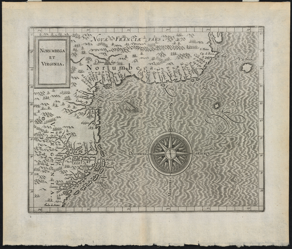
Wytfliet's publication was essentially the first atlas devoted solely to the Americas. It consisted of a world map, 18 regional maps, and a text on the discovery, natural history, and geography of the New World. Displayed here is the map that depicted the northeastern coast of North America from the Carolinas to New England. The map named Virginia shortly after Sir Walter Raleigh's failure to settle a colony at Roanoke. The name Norumbega designated the unknown lands of northeastern America until John Smith explored the region and published his map of 1614 christening the territory New England.
- Creator:
- Wytfliet, Corneille
- Date:
-
[1597?]
- Format:
-
Maps/Atlases
- Location:
- Private Collection
- Collection (local):
-
Mapping Boston Collection
- Subjects:
-
Atlantic States--Maps--Early works to 1800
North America--Discovery and exploration--Maps
North America--Maps--Early works to 1800
- Places:
-
New England (area)
Middle Atlantic (area)
- Extent:
- 1 map ; 22 x 28 cm.
- Terms of Use:
-
No known copyright restrictions.
This work is licensed for use under a Creative Commons Attribution Non-Commercial Share Alike License (CC BY-NC-SA).

- Publisher:
-
Louvain :
s.n.
- Scale:
-
Scale not given
- Language:
-
Latin
- Notes:
-
Scale [ca. 1:5,000,000], measurement derived from latitude bar (1⁰ = 22 mm.).
Covers coast from R. Primero in the north to Buelta de Arenas in the south.
Relief shown pictorially.
Shows rivers and Native American settlements.
In Latin.
Detached from: Histoire universelle des Indes orientales et occidentales / C. Wytfliet.
Appears in Wytfliet's Descriptionis Ptolemaicae augmentum. Louvain. 1597.
"17"--Upper right corner.
- Identifier:
-
06_01_001234
- Barcode:
-
39999052508247


