Map of the existing and proposed circumferential thoroughfares of the district
Item Information
- Title:
- Map of the existing and proposed circumferential thoroughfares of the district
- Title (alt.):
-
Commonwealth of Massachusetts Metropolitan Improvements Commission
- Description:
-
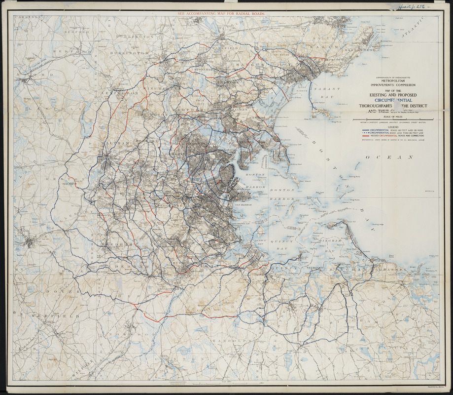
A comprehensive plan for improving traffic in the growing Boston urban area was submitted to the Metropolitan Improvements Commission in 1909 by Shurtleff, a visionary landscape architect. His scheme was simple, logical, and much ahead of its time. He proposed widening the radial roads emanating from the core and intersecting them with a series of concentric ring roads. Shown here are the existing and proposed circumferential roads. A half century before Routes 128 and 495 would be completed, their necessity had been anticipated.
- Contributor:
- Massachusetts. Metropolitan Improvements Commission
- Creator:
- Shurcliff, Arthur A. (Arthur Asahel), 1870-1957
- Name on Item:
-
Arthur A. Shurtleff ; Commonwealth of Massachusetts Metropolitan Improvements Commission
- Date:
-
1909
- Format:
-
Maps/Atlases
- Location:
- Private Collection
- Collection (local):
-
Mapping Boston Collection
- Subjects:
-
Highway planning--Massachusetts--Boston--Maps
Boston (Mass.)--Maps
- Places:
-
MassachusettsSuffolk (county)Boston
- Extent:
- 1 map : col. ; 70 x 83 cm.
- Terms of Use:
-
No known copyright restrictions.
This work is licensed for use under a Creative Commons Attribution Non-Commercial Share Alike License (CC BY-NC-SA).

- Publisher:
-
Boston :
Commonwealth of Massachusetts, Metropolitan Improvements Commission
- Scale:
-
Scale 1:62,500
- Language:
-
English
- Notes:
-
Relief shown by contours.
Thoroughfares overprinted on map derived from U.S.G.S. topographical maps.
Né Shurtleff, name changed in 1930.
- Identifier:
-
06_01_001153
- Barcode:
-
39999052508205


