Plan of Boston
Item Information
- Title:
- Plan of Boston
- Description:
-
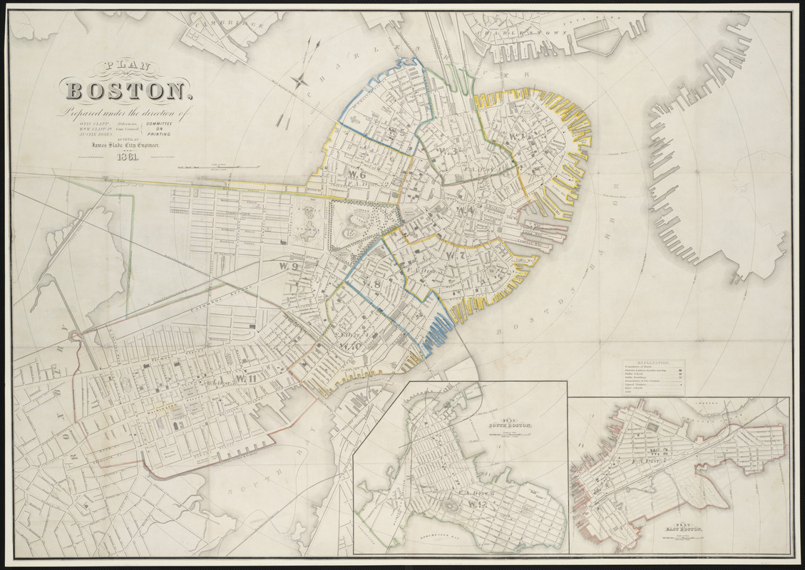
At the direction of the Boston City Council, city engineer James Slade produced this new map of the city. It was first published in 1861 and was reissued, with updates, every year from 1862 through 1870, with the exception of 1865. This detailed map depicts wards, fire districts, streets, railroads, wharves, and public buildings throughout Boston proper, as well as in the two insets covering East and South Boston. This first edition documents the beginning stages of the filling in of the eastern portion of Back Bay.
- Creator:
- Slade, James
- Contributor:
- Wightman, H. M.
- Contributor:
- Swett, C. A. (Cyrus A.)
- Contributor:
- Boston (Mass.). Engineering Dept
- Name on Item:
-
prepared under the direction of ... Committee on Printing of 1860, by James Slade ; drawn by H.M. Wightman ; engraved by C.A. Swett
- Date:
-
1861
- Format:
-
Maps/Atlases
- Location:
- Private Collection
- Collection (local):
-
Mapping Boston Collection
- Subjects:
-
Boston (Mass.)--Maps
- Places:
-
Suffolk (county)Boston
- Extent:
- 1 map : col. ; 27 x 39 inches.
- Terms of Use:
-
No known copyright restrictions.
This work is licensed for use under a Creative Commons Attribution Non-Commercial Share Alike License (CC BY-NC-SA).

- Publisher:
-
Boston :
Boston City Council]
- Scale:
-
Scale 1:6,000
- Language:
-
English
- Notes:
-
Includes insets: Plan of South Boston and Plan of East Boston.
- Identifier:
-
06_01_001169
- Barcode:
-
39999052508130


