United States of America
Item Information
- Title:
- United States of America
- Description:
-
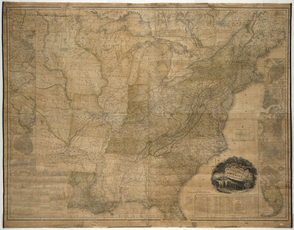
Tanner, the first native-born American to devote his career to map and atlas publishing, copyrighted this large wall map of the United States in1829. It depicts only the eastern two-thirds of the country, while the margins are lined with sixteen insets. Most of these insets document America's major cities, including two pertaining to Boston. At this time, there were only two states west of the Mississippi - Louisiana and Missouri. The remainder of the Great Plains was allotted to various Native American groups. As evidence of the nation's interest in “manifest destiny,” there is also an inset of the Pacific Northwest, recently explored by Lewis and Clark.
- Creator:
- Tanner, Henry Schenck, 1786-1858
- Name on Item:
-
H.S. Tanner ; engraved by H. S. Tanner, assisted by F.B. Dawson, W. Allen & J. Knight
- Date:
-
1829
- Format:
-
Maps/Atlases
- Location:
- Private Collection
- Collection (local):
-
Mapping Boston Collection
- Subjects:
-
United States--Maps
- Places:
-
- Extent:
- 1 map : col. ; 115 x 155 cm.
- Terms of Use:
-
No known copyright restrictions.
This work is licensed for use under a Creative Commons Attribution Non-Commercial Share Alike License (CC BY-NC-SA).

- Publisher:
-
Philadelphia :
[s.n.]
- Scale:
-
Scale ca. 1:2,000,000
- Language:
-
English
- Notes:
-
Relief shown by hachures.
Prime meridian: Washington.
With 16 inset maps including "Oregon and Mandan Districts", profiles, and statistical tables.
- Identifier:
-
06_01_001167
- Barcode:
-
39999052508106


