Noua Anglia, Nouum Belgium, et Virginia
Item Information
- Title:
- Noua Anglia, Nouum Belgium, et Virginia
- Title (alt.):
-
Nova Anglia, Novum Belgium, et Virgina
- Description:
-
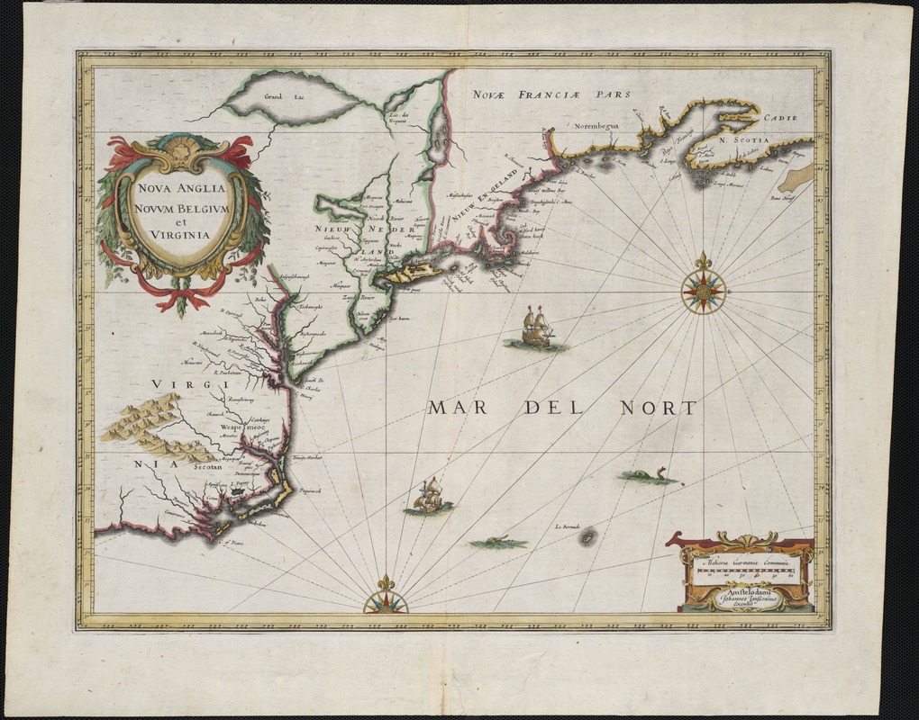
Covering the eastern portion of North America's coastline from North Carolina to Nova Scotia, this influential map appeared in English, German, Latin, Dutch, and French editions of world atlases published by Hondius and Jansson from 1636 - 1653. Reflecting recent English settlement in the New England area, the map carries the familiar place names of, Massachusetts, Plymouth, Boston (Briston), and Cape Cod. Jansson, the son of a mapmaker and publisher, married into a leading Dutch publishing house. With his brother-in-law, he led the Hondius firm in a rivalry with the Blaeu publishing house that spurred Dutch mapmaking to deserved prominence.
- Creator:
- Jansson, Jan, 1588-1664
- Name on Item:
-
Johannes Janssonius, excudit.
- Date:
-
[1636?]
- Format:
-
Maps/Atlases
- Location:
- Private Collection
- Collection (local):
-
Mapping Boston Collection
- Subjects:
-
North America--Maps--Early works to 1800
New England--Maps--Early works to 1800
New York (State)--Maps--Early works to 1800
Virginia--Maps--Early works to 1800
- Places:
-
North America (area)
Virginia
New England (area)
New York
- Extent:
- 1 map : hand col. ; 36 x 48 cm.
- Terms of Use:
-
No known copyright restrictions.
This work is licensed for use under a Creative Commons Attribution Non-Commercial Share Alike License (CC BY-NC-SA).

- Publisher:
-
Amstelodami :
[s.n.]
- Scale:
-
Scale [ca. 1:5,200,000]
- Language:
-
Latin
- Notes:
-
Relief shown pictorially.
Title in heart-shaped cartouche in upper left of map.
Verso: The description of New England, p. 442, 441. Catchword: New. Cf. Cumming, W.P.
- Identifier:
-
06_01_001166
- Barcode:
-
39999052507645


