A new and accurat map of the world
Item Information
- Title:
- A new and accurat map of the world
- Description:
-
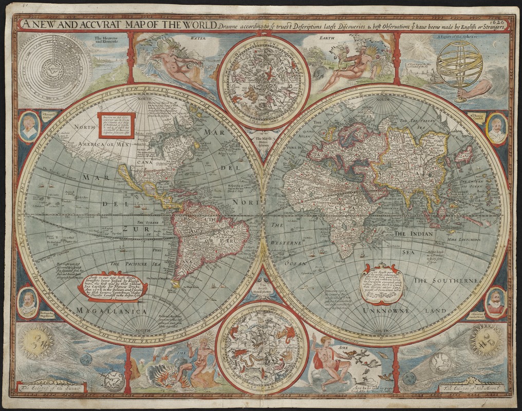
Reflecting the artistic style of his Dutch colleagues, English historian and mapmaker, John Speed, published this beautiful double hemisphere world map for inclusion in his world atlas. It was one of the earliest maps to show California as an island as well as the settlement of New Plymouth, which was founded in 1620. The map's decorative elements include vignettes of the four elements, Earth, Water, Fire, and Air, with symbolic human figures, and northern and southern celestial hemispheres. There are also diagrams of eclipses and an Earth-centered universe. Flanking the hemispheres are the portraits of four influential circumnavigators: Magellan, Drake, Cavendish, and van de Noort.
- Creator:
- Speed, John, 1552?-1629
- Name on Item:
-
drawne according to ye truest descriptions latest discoveries & best observations yt have beene made by English or strangers, 1626.
- Date:
-
1626
- Format:
-
Maps/Atlases
- Location:
- Private Collection
- Collection (local):
-
Mapping Boston Collection
- Subjects:
-
World maps--Early works to 1800
- Places:
-
World
- Extent:
- 1 map : hand col. ; 2 hemispheres each 25 cm. in diam. on sheet 40 x 52 cm.
- Terms of Use:
-
No known copyright restrictions.
This work is licensed for use under a Creative Commons Attribution Non-Commercial Share Alike License (CC BY-NC-SA).

- Publisher:
-
[London] :
Are to be sold in pops-head Alle by Geor. Humble
- Scale:
-
Scale: ca. 1:50,000,000.
- Language:
-
English
- Notes:
-
Relief shown pictorially.
Text on verso: The generall description of the world.
Appears in Speed's A prospect of the most famous parts of the world. London. 1627.
- Identifier:
-
06_01_001148
- Barcode:
-
39999052507637


![Hemispheriu[m] ab aequinoctiali linea, ad circulu[m] Poli Arctici](https://bpldcassets.blob.core.windows.net/derivatives/images/commonwealth:3f462s45p/image_thumbnail_300.jpg)

